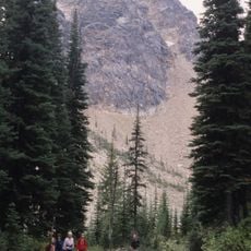
Finn Creek Protected Area, protected area in British Columbia, Canada
Location: Thompson-Nicola Regional District
GPS coordinates: 51.91556,-119.32417
Latest update: November 22, 2025 08:29

Wire Cache Provincial Park
21.6 km
Meadow Falls
48.2 km
Caligata Lake Provincial Park
40.5 km
Finn Creek Provincial Park
3.8 km
McDougall Falls
42.5 km
Upper Adams River Provincial Park
33.9 km
Blue River Black Spruce Provincial Park
25 km
Upper Seymour River Provincial Park
43.7 km
Blue River Pine Provincial Park
22.5 km
Mud Lake Delta Provincial Park
25.4 km
Oregana Creek Provincial Park
18.1 km
Harbour Dudgeon Lakes Provincial Park
40.3 km
Peekaboo Falls
45.4 km
Foster Glacier
46.9 km
Porte d'Enfer Rapids
6 km
Silvertip Falls
44.4 km
Little Hell's Gate Regional Park
1.8 km
Silvertip falls viewpoint
45.1 km
Ida Falls
47.3 km
Sheila Lake View Point
43.3 km
Waterfall
39 km
Waterfall
45.1 km
Meadow Falls
47.6 km
Allison Falls
41.8 km
Waterfall
42.3 km
Waterfall
24.8 km
McDougall Falls
42.5 km
Waterfall
42.4 kmReviews
Visited this place? Tap the stars to rate it and share your experience / photos with the community! Try now! You can cancel it anytime.
Discover hidden gems everywhere you go!
From secret cafés to breathtaking viewpoints, skip the crowded tourist spots and find places that match your style. Our app makes it easy with voice search, smart filtering, route optimization, and insider tips from travelers worldwide. Download now for the complete mobile experience.

A unique approach to discovering new places❞
— Le Figaro
All the places worth exploring❞
— France Info
A tailor-made excursion in just a few clicks❞
— 20 Minutes