Lower Raush Protected Area, protected area in British Columbia, Canada
Location: Regional District of Fraser-Fort George
GPS coordinates: 53.14278,-120.03528
Latest update: November 21, 2025 16:14
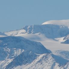
Mount Sir Wilfrid Laurier
43.2 km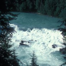
Rearguard Falls Provincial Park
49.1 km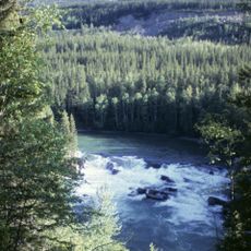
Rearguard Falls
49.1 km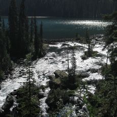
Cariboo Mountains Provincial Park
43.3 km
Small River Caves Provincial Park
35.7 km
Jackman Flats Provincial Park
46.6 km
Swiftcurrent Falls
47.8 km
West Twin Provincial Park and Protected Area
45.2 km
David Glacier
48 km
Holliday Creek Arch Protected Area
14.7 km
West Twin Provincial Park
41.4 km
Sunshine Creek Ecological Reserve
24 km
Upper Raush Protected Area
20.3 km
Tête Glacier
43.1 km
Rainbow Falls
19.5 km
Laurier Glacier
43.4 km
Kiwa Glacier
38.6 km
North Canoe Glacier
48.4 km
Swiftcurrent Glacier
49.2 km
McLennan Glacier
47.6 km
Gilmour Glacier
46.3 km
Rearguard Falls
48.7 km
Scenic viewpoint
48.7 km
Bluff Trail town view
22.1 km
Scenic viewpoint
45.5 km
Scenic viewpoint
45.8 km
Waterfall
38.1 km
Waterfall
45.9 kmReviews
Visited this place? Tap the stars to rate it and share your experience / photos with the community! Try now! You can cancel it anytime.
Discover hidden gems everywhere you go!
From secret cafés to breathtaking viewpoints, skip the crowded tourist spots and find places that match your style. Our app makes it easy with voice search, smart filtering, route optimization, and insider tips from travelers worldwide. Download now for the complete mobile experience.

A unique approach to discovering new places❞
— Le Figaro
All the places worth exploring❞
— France Info
A tailor-made excursion in just a few clicks❞
— 20 Minutes