Tongrube Frick, Clay pit in Frick, Switzerland
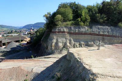
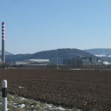
Tongrube Frick is a clay pit in an industrial zone where layers of rock from different periods of Earth are visible in the excavation walls. The exposed strata show different colors and materials that tell the story of how this landscape formed over millions of years.
The pit began as a source for industrial clay extraction, but gained recognition when workers uncovered ancient fossils during excavation work. These findings revealed that this area once hosted early reptile species from a distant geological time.
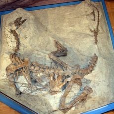
The site connects closely with the Sauriermuseum, where visitors can see fossils and learn how scientists study these discoveries from the past. The museum's collection shows what once lived in this area and how the local community values preserving this history.
The site can be visited through guided tours organized by the adjacent museum, with group reservations recommended in advance. Weather conditions affect access, so dry days are best for exploring the excavation area safely.
The pit holds one of Europe's largest collections of Plateosaurus skeletons, giving scientists exceptional material to study these ancient reptiles. The sheer quantity of remains provides insights into how these creatures lived and evolved during their time.
The community of curious travelers
AroundUs brings together thousands of curated places, local tips, and hidden gems, enriched daily by 60,000 contributors worldwide.