
回营清真寺
Location: Nanjian Yi Autonomous County
GPS coordinates: 24.84117,100.30992
Latest update: November 3, 2025 14:10
Xiaowan Dam
26.7 km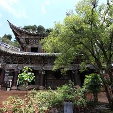
Changchun Cave
36.8 km
Qinghualukongque Provincial Natural Reserve
19.3 km
南涧彝族自治县博物馆
31.6 km
巍宝山古建筑群
38 km
茂兰茶马古道
31.1 km
Weibao Mountain
37.1 km
Xiaowan Dam
26.8 km
Scenic viewpoint
36.8 km
Nanjian Earth Forest
29.3 km
茶马古道凤庆段
31.6 km
长春洞
37.1 km
浮雕
38 km
Man Wan Dam
28.2 km
Nanjian Earth Forest
30.9 km
Scenic viewpoint
22.9 km
Scenic viewpoint
22.9 km
灵宝山
21 km
Cherry Flower Valley
23.1 km
Scenic viewpoint
37 km
Scenic viewpoint
32.4 km
Pagoda
36.4 km
巍宝山古建筑群文保碑
37.9 km
道士墓
37.9 km
Commemorative plaque, memorial
37.9 km
清代碑记
37.8 km
清代碑记
37.8 km
太极
36.8 kmReviews
Visited this place? Tap the stars to rate it and share your experience / photos with the community! Try now! You can cancel it anytime.
Discover hidden gems everywhere you go!
From secret cafés to breathtaking viewpoints, skip the crowded tourist spots and find places that match your style. Our app makes it easy with voice search, smart filtering, route optimization, and insider tips from travelers worldwide. Download now for the complete mobile experience.

A unique approach to discovering new places❞
— Le Figaro
All the places worth exploring❞
— France Info
A tailor-made excursion in just a few clicks❞
— 20 Minutes