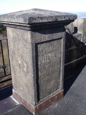
Valtenberg, Mountain summit in Neukirch/Lausitz, Germany.
Valtenberg is a mountain summit in the Lusatian highlands of southeastern Saxony that reaches 586.6 meters in elevation. The peak features an observation tower at its top and is accessible through marked trails from nearby parking areas.
The König-Johann-Turm observation tower was built on the summit for military surveillance purposes and later transitioned to serve as a public viewing platform. This shift reflects how the mountain changed from strategic military importance to recreational use.
The summit holds both German and Upper Sorbian names, reflecting the bilingual heritage that remains part of local identity and place naming in this region.
Access is provided through marked trails from the Sonneneck parking area, with several route options available for different hiking abilities. A mountain hut on the summit offers rest and refreshments during operating hours.
The Legend Path is a newer hiking route that features digital elements with QR codes presenting local folklore stories and riddles to visitors. This interactive trail blends traditional regional narratives with contemporary technology in an unexpected way.
Location: Neukirch/Lausitz
Elevation above the sea: 586.6 m
GPS coordinates: 51.07403,14.27784
Latest update: December 10, 2025 20:08
Neukirch West railway station
1.3 km
Schenkhauserstr.25
2.2 km
Stufenweg
845 m
Güttlermühle
2.6 km
Station 6 Valtenberg
63 m
Dresdner Straße 3
2.6 km
Knochenstampfe Neukirch
2.4 km
Blockhaus (sogenanntes Jagdschloss) ohne späteren südlichen Anbau Ziegelbergstraße 25
1.2 km
Knochenmühle
2.5 km
Wohnhaus (Umgebinde) Dresdner Straße 24
2.6 km
Gärtnerei Milius; Wohnhaus (Umgebinde) und Scheune Georgenbadstraße 2
2.6 km
Hauptstraße 116 Neukirch/Lausitz
2.7 km
Gartenpavillon Hauptstraße 141a
2.7 km
Wohnhaus (ehemaliges Umgebindehaus) Hauptstraße 151
2.7 km
Alte Straße 20
2.6 km
Waystone
812 m
Wohnstallhaus Schenkhäuserstraße 15
2.3 km
Wohnhaus (Umgebinde) Dorfweg 31
2.6 km
Wohnhaus Schenkhäuserstraße 25 (zu)
2.2 km
Wohnstallhaus und Scheune eines Winkelhofes Schenkhäuserstraße 16
2.3 km
Wohnhaus (Umgebinde) Alte Straße 31
2.5 km
Gasthof „Hübelschänke“ über winkligem Grundriss und Scheunenanbau Schenkhäuserstraße 17
2.3 km
Dorfweg 28
2.5 km
Dorfweg 27
2.5 km
Wohnhaus (Umgebinde) Dorfweg 45
2.5 km
Dammweg 30
2.6 km
Gasthof „Waldschlößchen“ mit zum Teil originaler Ausstattung Karl-Berger-Straße 17
2.4 km
Villa im Landhausstil und Wohnhaus mit Garagen Dammweg 29
2.7 kmVisited this place? Tap the stars to rate it and share your experience / photos with the community! Try now! You can cancel it anytime.
Discover hidden gems everywhere you go!
From secret cafés to breathtaking viewpoints, skip the crowded tourist spots and find places that match your style. Our app makes it easy with voice search, smart filtering, route optimization, and insider tips from travelers worldwide. Download now for the complete mobile experience.
A unique approach to discovering new places❞
— Le Figaro
All the places worth exploring❞
— France Info
A tailor-made excursion in just a few clicks❞
— 20 Minutes