Fietsallee am Nordkanal, Radweg am Nordkanal in der niederländisch-deutschen Grenzregion
The Fietsallee am Nordkanal is a cycling route of about 100 kilometers running from Neuss on the Rhine toward the Dutch border. The path follows a flat course with minimal elevation and is marked with a blue-green band on the ground, posts, and street lamps, making it easy for cyclists of all levels to stay on track.
The route follows the path of the North Canal, an ambitious project from the early 1800s that French Emperor Napoleon planned to connect the Rhine and Maas rivers and boost regional trade. Construction started in 1810 but was never completed after Napoleon's fall, leaving behind remains like old locks and bridges that tell the story of this unfinished waterway.
The route is named after the North Canal, an ambitious project once meant to transform trade and transport in the region. Today, locals use the path for weekend outings with family and friends, often stopping for picnics at quiet spots along the water.
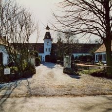
The route is accessible year-round and is especially pleasant in good weather. Parking areas, information boards, and distance markers are located at various points along the path, making orientation easy for travelers.
The route features a striking blue-green line painted on the ground that resembles a giant measuring tape, along with special striped poles marking the canal's path. Near Venlo in the Netherlands, miniature versions of the markers are mounted on street lamps, showing how carefully this historical route has been documented.
The community of curious travelers
AroundUs brings together thousands of curated places, local tips, and hidden gems, enriched daily by 60,000 contributors worldwide.