Ruhn Hills, Terminal moraine summit in Mecklenburg-Western Pomerania, Germany
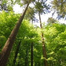
The Ruhn Hills form a sickle-shaped ridge stretching across the border between Brandenburg and Mecklenburg-Western Pomerania with a highest point around 177 meters. Mixed forests cover the entire formation, crossed by numerous hiking trails that connect different viewpoints along the crest.
This ridge formed during the Pomeranian stage of the Weichselian glaciation, when massive ice forces reshaped and pushed the landscape into its current form. The glacial processes that created it occurred thousands of years ago, leaving behind the terrain that defines this region today.
The summit hosts a brick observation tower built in 2001 to replace an older wooden structure from 1933, where visitors gather to take in views of the forested landscape below. Local communities use this spot for seasonal events and gatherings throughout the year.
The summit is accessible via several trails, though the difficulty varies depending on which route you choose to take from below. Sturdy footwear is recommended, especially during wet seasons or after rainfall when the paths can become slippery.
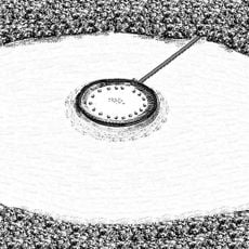
Next to the main summit marker stands a survey point called the FF Rock, named after Frederick Francis II who commissioned the state survey of Mecklenburg. This historical benchmark reveals the ridge's role in mapping efforts during the 1800s.
The community of curious travelers
AroundUs brings together thousands of curated places, local tips, and hidden gems, enriched daily by 60,000 contributors worldwide.