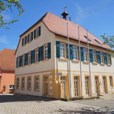
Schloss Sindlingen, Water castle in Jettingen, Germany
Schloss Sindlingen is a water castle near Jettingen built as a moated fortress with a three-story corner section in half-timbered style. The structure occupies a landscape park setting where multiple wings form a courtyard arrangement characteristic of fortified manor houses from earlier centuries.
The castle began as a fortified water manor in the 15th century and underwent substantial reconstruction in 1782 under Franziska von Hohenheim. Later work deliberately altered portions of the complex to adapt the building for different uses.
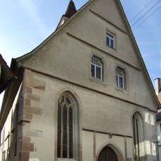
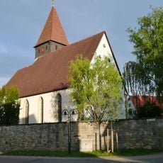
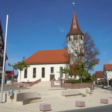
The evangelical chapel, first documented in 1275, represents early religious architecture and received structural modifications during the 16th century.
The property operates as a holiday hotel and equestrian center with riding lessons available throughout the year. Visitors should note that access is primarily arranged through its function as a private accommodation and riding facility.
The property retains its original four-wing medieval layout despite deliberate removal of certain sections during 19th-century restructuring. This preservation choice shaped how the complex appears to visitors today.
Location: Jettingen
GPS coordinates: 48.56940,8.81020
Latest update: December 9, 2025 12:26
Memorial Hailfingen-Tailfingen concentration camp
4.7 km
Pommerlesloch
3 km
Ammerquellen im Oberen Tal
3.7 km
Spitalkirche Herrenberg
5.3 km
Schmalbachtal nordwestlich von Tailfingen
4.6 km
Stephanskirche Nebringen
2.8 km
Ammertal vom Ursprung bis zur Kochmühle mit Umgebung
4.1 km
Martinskirche
2.7 km
Gebiet um Kuppinger und Jettinger Weg
2.3 km
Stephanuskirche
5.2 km
Peterskirche
5.1 km
Mauritiuskirche
44 m
Double bind
4.7 km
Nördlicher Teil des Kühlenberges
5.2 km
Lindenalle-Haldenäcker
497 m
Auferstehungskirche
2.7 km
Linde in den Schloßwiesen
476 m
4 Mostbirnbäume Haldenäcker
525 m
3 Linden auf den Roggenäckern
510 m
Rathaus Gültstein
5.1 km
Ahorn- und Lindenallee an Wagners Grund
820 m
Esche mit Efeu auf dem Friedhof
170 m
3 Eisberg-Pappeln (Nr. 327)
5.2 km
Altes Schulhaus Gültstein
5.1 km
Ehem. Farrenstall
5.1 km
Blutbuche an der Kirche
2.7 km
Mittleres Bergle (Nr. 337)
5.2 km
Obstbaum- und Lindenallee am Dreispitz
760 mVisited this place? Tap the stars to rate it and share your experience / photos with the community! Try now! You can cancel it anytime.
Discover hidden gems everywhere you go!
From secret cafés to breathtaking viewpoints, skip the crowded tourist spots and find places that match your style. Our app makes it easy with voice search, smart filtering, route optimization, and insider tips from travelers worldwide. Download now for the complete mobile experience.
A unique approach to discovering new places❞
— Le Figaro
All the places worth exploring❞
— France Info
A tailor-made excursion in just a few clicks❞
— 20 Minutes