Ditschhardt, hill in Germany
Location: Rhineland-Palatinate
GPS coordinates: 50.51720,6.97871
Latest update: November 21, 2025 01:17
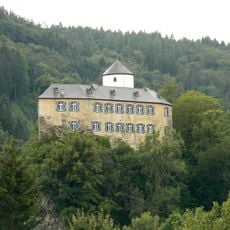
Burg Kreuzberg
909 m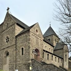
Maria Verkündigung
882 m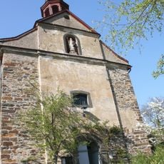
St. Antonius
888 m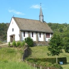
St.-Maternus-Kapelle
813 m
Lingen-Berg
924 m
Nikolauskapelle
993 m
Scenic viewpoint
494 m
Barmherziger Jesus
496 m
Scenic viewpoint
819 m
Scenic viewpoint
817 m
Schwarzes Kreuz
853 m
Teufelsloch
864 m
Scenic viewpoint
909 m
Scenic viewpoint
448 m
Cloos`sche Falte
915 m
Wayside shrine
934 m
Wayside shrine
845 m
Neben dem Schwarzen Kreuz
991 m
Wayside cross
541 m
Wayside shrine, Christianity
692 m
St.-Josef-Bildstock Altenahr
737 m
Wayside shrine
1.1 km
Wayside shrine
900 m
Memorial
927 m
Leo Schweitzer
1.1 km
Jutta Menzner
847 m
J. Nicolas Ponsart
966 m
Christianity, Catholic church building, wayside shrine
971 mReviews
Visited this place? Tap the stars to rate it and share your experience / photos with the community! Try now! You can cancel it anytime.
Discover hidden gems everywhere you go!
From secret cafés to breathtaking viewpoints, skip the crowded tourist spots and find places that match your style. Our app makes it easy with voice search, smart filtering, route optimization, and insider tips from travelers worldwide. Download now for the complete mobile experience.

A unique approach to discovering new places❞
— Le Figaro
All the places worth exploring❞
— France Info
A tailor-made excursion in just a few clicks❞
— 20 Minutes