
Grenzstein Nr. 4, des ehemaligen Burgfriedens der Stadt Mühldorf a. Inn, gesetzt 1664/65
Location: Mühldorf am Inn
Address: Nähe Lohmühle
GPS coordinates: 48.22695,12.54663
Latest update: November 21, 2025 13:09
Mühldorfer Straße 10, Polling
1.6 km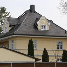
Villa
1.7 km
Cultural heritage D-1-7741-0080 in Polling (bei Mühldorf am Inn)
1.7 km
Cultural heritage D-1-7741-0071 in Polling (bei Mühldorf am Inn)
1.7 km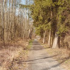
Natur INN Bewegung
1.5 km
Grenzstein Nr. 5 (Süd)
262 m
Grenzstein Nr. 2 (Süd)
538 m
Grenzstein Nr. 3 (Süd)
198 m
Grenzstein Nr. 1 (Süd)
1 km
Grenzstein Nr. 9 (Süd)
1.5 km
Grenzstein Nr. 8 (Süd)
1.5 km
Grenzstein
517 m
Austragshaus Moosschneiderweg 14 in Polling (bei Mühldorf am Inn)
1.2 km
Cultural heritage D-1-7741-0099 in Polling (bei Mühldorf am Inn)
710 m
Kornspeicher Moosschneiderweg 14 in Polling (bei Mühldorf am Inn)
1.3 km
Cultural heritage D-1-7741-0249 in Polling (bei Mühldorf am Inn)
1.7 km
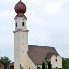
Mariä Heimsuchung
1.7 km
Sauloch
1.5 km
Wayside shrine
1.5 km
Wayside cross
1.6 km
Wayside shrine
1.2 km
Wayside cross
575 mReviews
Visited this place? Tap the stars to rate it and share your experience / photos with the community! Try now! You can cancel it anytime.
Discover hidden gems everywhere you go!
From secret cafés to breathtaking viewpoints, skip the crowded tourist spots and find places that match your style. Our app makes it easy with voice search, smart filtering, route optimization, and insider tips from travelers worldwide. Download now for the complete mobile experience.

A unique approach to discovering new places❞
— Le Figaro
All the places worth exploring❞
— France Info
A tailor-made excursion in just a few clicks❞
— 20 Minutes