
Blockbau-Stadel, mit Steildach und Bundwerk, 18./19. Jahrhundert; zugehörig zu ehemaligen Vierseithof
Location: Vilsbiburg
Address: Zeiling, Haus Nr. 79
GPS coordinates: 48.44005,12.38221
Latest update: November 22, 2025 05:43
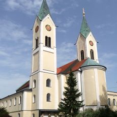
Wallfahrtskirche Maria-Hilf
1.5 km
Feldkapelle
485 m
Wegkapelle
493 m
Kapelle
1.4 km
Feldkapelle
434 m
Scheune Nähe Prölling in Bodenkirchen
901 m
Kornspeicher Eibelswimm 57 in Vilsbiburg
1.4 km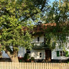
Bauernhaus
1.5 km
Wohnstallhaus
839 m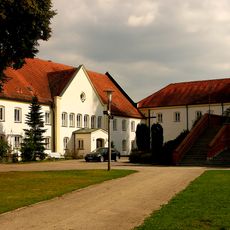
Kapuzinerkloster Maria Hilf
1.5 km
Wohnstallhaus eines Dreiseithofs mit Getreidekasten
1.4 km
Scheune Thalham 53 in Vilsbiburg
1.5 km
Kapuzinerkloster Mariahilf 2 in Vilsbiburg
1.5 km
Kornspeicher Kleingrub 29 1/5 in Vilsbiburg
411 m
Scheune Nähe Prölling in Bodenkirchen
890 m
Nebengebäude Thalham 53 in Vilsbiburg
1.5 km
Ehemaliges Bauernhaus
392 m
Taubenhaus Thalham 53 in Vilsbiburg
1.5 km
Dreiseithof mit Taubenkobel
1.5 km
Kleinbauernhaus
97 m
Vierseithof mit Stadel
883 m
Klostergebäude Mariahilf 1 in Vilsbiburg
1.5 km
Tenne Nähe Prölling in Bodenkirchen
871 m
Christianity, Catholic church building, wayside cross
1.2 km
Wayside cross
1.3 km
Wayside cross
1.2 km
Hl. Antonius
853 m
Wayside cross
1.4 kmReviews
Visited this place? Tap the stars to rate it and share your experience / photos with the community! Try now! You can cancel it anytime.
Discover hidden gems everywhere you go!
From secret cafés to breathtaking viewpoints, skip the crowded tourist spots and find places that match your style. Our app makes it easy with voice search, smart filtering, route optimization, and insider tips from travelers worldwide. Download now for the complete mobile experience.

A unique approach to discovering new places❞
— Le Figaro
All the places worth exploring❞
— France Info
A tailor-made excursion in just a few clicks❞
— 20 Minutes