
Mundloch des Schwarzer-Bär-Stollns
Mundloch des Schwarzer-Bär-Stollns, Stollnmundloch mit Wangenmauern, Zeugnis der bergmännischen Vergangenheit, von lokalgeschichtlicher Bedeutung. Mundloch einer Eisenerz- und Kobaltgrube aus grober, gemauerter Granitquadereinfassung in Form eines gestelzten Bogens und anlaufenden Wa
Location: Eibenstock
Inception: 1640
Address: Sosa
GPS coordinates: 50.51253,12.63975
Latest update: November 21, 2025 05:56
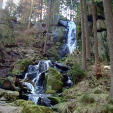
Blauenthaler Wasserfall
1.1 km
Teufelsschloss (Eibenstock)
1.2 km
Dürrer Berg
686 m
Binge Bockauer Straße -
983 m
Ehemaliges Huthaus und Schuppen der Himmelfahrt Christi Fundgrube und -Stolln Himmelfahrt 4
1.3 km
Wohnhaus (mit integriertem Scheunenteil) und Seitengebäude eines Bauernhofes Bockauer Straße 40
906 m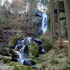
Blauenthaler Wasserfall
976 m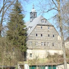
Hammerherrenhaus Blauenthal
830 m
Hammergut Blauenthal
830 m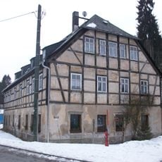
Wohnhaus Zimmersacherstraße 4
931 m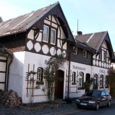
Hotel- und Restaurantbau mit Nebengebäude Zimmersacherstraße 2
1 km
Einzeldenkmale der Sachgesamtheit Hammergut Blauenthal: Keller mit Vorbau und Holzschuppen (siehe auch Sachgesamtheitsliste – Obj. 09305444, Blauenthaler Hauptstraße 2-4) Am Zinnsteig -
830 m
Wohnhaus Zimmersacherstraße 3
956 m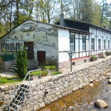
Gartenrestaurant (ohne Anbauten) auf der anderen Flussseite Zimmersacherstraße 2 (gegenüber)
977 m
Wohnstallhaus und Scheune eines Bauernhofes Bockauer Straße 23
1.2 km
Straßenbrücke über die Große Bockau, mit Uferbefestigung Blauenthaler Hauptstraße 7
1 km
Pochsohle
1.1 km
Einzeldenkmale der Sachgesamtheit Hammergut Blauenthal: Wohnhaus (siehe auch Sachgesamtheitsliste – Obj. 09305444, Blauenthaler Hauptstraße 2-4) Am Zinnsteig 1
830 m
Binge Bockauer Straße -
866 m
Binge Bockauer Straße -
1 km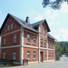
Wohnhaus Blauenthaler Hauptstraße 9
1.1 km
Einzeldenkmale der Sachgesamtheit Hammergut Blauenthal: Nebengebäude (siehe auch Sachgesamtheitsliste – Obj. 09305444, Blauenthaler Hauptstraße 2–4) Am Zinnsteig 2
830 m
Gedenkstein
1.2 km
Blauenthaler Wasserfall
1 km
Scenic viewpoint
707 m
Schulzenstein
1.2 km
Binge Müntzer Zeche
500 m
Denkmal "Letzter Bär vom Auersberg"
910 mReviews
Visited this place? Tap the stars to rate it and share your experience / photos with the community! Try now! You can cancel it anytime.
Discover hidden gems everywhere you go!
From secret cafés to breathtaking viewpoints, skip the crowded tourist spots and find places that match your style. Our app makes it easy with voice search, smart filtering, route optimization, and insider tips from travelers worldwide. Download now for the complete mobile experience.

A unique approach to discovering new places❞
— Le Figaro
All the places worth exploring❞
— France Info
A tailor-made excursion in just a few clicks❞
— 20 Minutes