Hammerweiher, protected landscape in Bavaria, Germany
Location: Amberg-Sulzbach
Inception: 1965
GPS coordinates: 49.62556,11.97528
Latest update: November 24, 2023 23:44

Hammerschloss Röthenbach
1.5 km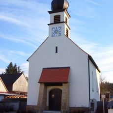
Maria Immaculata
1.8 km
Brauhaus Im Dorf 1 in Kohlberg (Oberpfalz)
1.5 km
Kriegergedenkstätte
1.5 km
Cultural heritage D-3-6337-0045 in Freihung
2.7 km
Wegkreuz
1.9 km
Cultural heritage D-3-6337-0015 in Kohlberg (Oberpfalz)
1.4 km
Waldkapelle
1.5 km
Hoftor Hauptstraße 9 in Freihung
2.6 km
Schlossökonomie Im Dorf 1 in Kohlberg (Oberpfalz)
1.4 km
Hofkapelle Im Dorf 1 in Kohlberg (Oberpfalz)
1.5 km
Kriegerdenkmal
2.6 km
Arbeiterwohnhaus, sogenanntes Langhaus
1.5 km
Bauernhof
2.7 km
Schlossökonomie Im Dorf 1 in Kohlberg (Oberpfalz)
1.5 km
Glasfabrik Im Dorf 9; Im Dorf 10 in Kohlberg (Oberpfalz)
1.4 km
Cultural heritage D-3-6337-0031 in Hirschau
2.6 km
Hoftor
2.6 km
Wayside cross
1.6 km
Memorial, war memorial
2.6 km
Wayside cross
2.5 km
Catholic church building, wayside cross, Christianity
2.6 km
Wayside shrine
2.5 km
Wayside cross
2.3 km
Christianity, Catholic church building, wayside cross
2.1 km
Wayside shrine
1.7 kmReviews
Visited this place? Tap the stars to rate it and share your experience / photos with the community! Try now! You can cancel it anytime.
Discover hidden gems everywhere you go!
From secret cafés to breathtaking viewpoints, skip the crowded tourist spots and find places that match your style. Our app makes it easy with voice search, smart filtering, route optimization, and insider tips from travelers worldwide. Download now for the complete mobile experience.

A unique approach to discovering new places❞
— Le Figaro
All the places worth exploring❞
— France Info
A tailor-made excursion in just a few clicks❞
— 20 Minutes