Toteiskessel W von Löfflmoos, Geotop in Landkreis Mühldorf a.Inn in Bavaria, Germany
Location: Maitenbeth
Elevation above the sea: 590 m
Length: 70 m
Width: 30 m
Website: http://www.umweltatlas.bayern.de/mapapps/resources/reports/geotope/generateBericht.pdf?additionallayerfieldvalue=183R011
GPS coordinates: 48.15508,12.12169
Latest update: October 2, 2024 17:03

Hofkapelle
1.6 km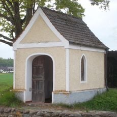
Weilerkapelle
1.9 km
Wieskapelle
1.7 km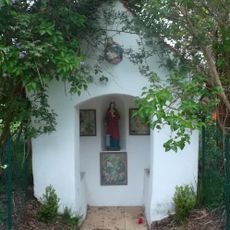
Wegkapelle
2.1 km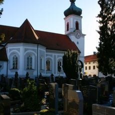
St. Agatha
2.2 km
Wohnteil eines Bauernhauses
1.6 km
Cultural heritage D-1-7838-0120 in Maitenbeth
2.2 km
Cultural heritage D-1-7838-0105 in Maitenbeth
1.2 km
Stadel
1.8 km
Wohnteil des erneuerten Hakenhofes
421 m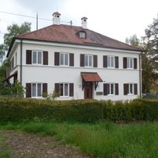
Pfarrhaus
2.2 km
Stadel eines ehemaligen Dreiseithofs
1.2 km
Hakenhof mit Wohnhaus vom Typ Haager Querhaus
2.3 km
Kirchplatz 7
2.2 km
Scheune Haslach 3 in Maitenbeth
1.7 km
Bauernhaus eines ehemaligen Parallelhofs
1.7 km
Hakenhof
1.7 km
Mitterstallbau
1.7 km
Ehemaliges Bauernhaus
1.7 km
Wayside cross
1.5 km
Wayside cross
2 km
Scenic viewpoint
1.9 km
Catholic church building, wayside cross, Christianity
1.7 km
Wayside cross
1.6 km
Wayside cross
1.3 km
Wayside cross
1.1 km
Wayside cross
2.2 km
Wayside cross, Christianity, Catholic church building
2.2 kmReviews
Visited this place? Tap the stars to rate it and share your experience / photos with the community! Try now! You can cancel it anytime.
Discover hidden gems everywhere you go!
From secret cafés to breathtaking viewpoints, skip the crowded tourist spots and find places that match your style. Our app makes it easy with voice search, smart filtering, route optimization, and insider tips from travelers worldwide. Download now for the complete mobile experience.

A unique approach to discovering new places❞
— Le Figaro
All the places worth exploring❞
— France Info
A tailor-made excursion in just a few clicks❞
— 20 Minutes