Wieskapelle, building in Maitenbeth, Upper Bavaria, Germany
Location: Maitenbeth
Address: Tiefenmoos, Bräustätter Feld
GPS coordinates: 48.14155,12.13132
Latest update: November 22, 2025 18:06

Toteiskessel NE von Höller
1.7 km
Hofbrunnen In der Flur Lohen in Maitenbeth
2 km
Bildstock
1.7 km
Haufenhof
1.9 km
Stadel
480 m
Wohnteil des erneuerten Hakenhofes
1.5 km
Scheune Weinhub 1 in Maitenbeth
1.2 km
Bauernhaus
1.6 km
Scheune Haslach 3 in Maitenbeth
1.5 km
Bauernhaus eines ehemaligen Parallelhofs
1.7 km
Mitterstallbau
543 m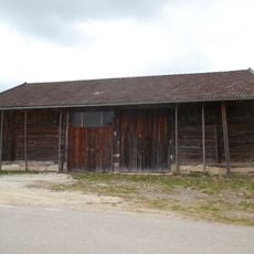
Stadel
2.2 km
Hakenhof mit Wohnhaus vom Typ Haager Querhaus
1.1 km
Ehemaliges Bauernhaus
1.6 km
Stadel eines ehemaligen Dreiseithofs
1.1 km
Toteiskessel NW von Grub
1.1 km
Scheune Lohen 4 in Maitenbeth
1.9 km
Hakenhof
1.5 km
Stallstadel
1.6 km
Toteiskessel W von Löfflmoos
1.7 km
Stall Lohen 4 in Maitenbeth
1.9 km
Backhaus Lohen 4 in Maitenbeth
1.9 km
Scenic viewpoint
1.5 km
Wayside cross
1.6 km
Wayside cross
735 m
Wayside cross
2 km
Wayside cross
2 km
Wayside cross
2.1 kmReviews
Visited this place? Tap the stars to rate it and share your experience / photos with the community! Try now! You can cancel it anytime.
Discover hidden gems everywhere you go!
From secret cafés to breathtaking viewpoints, skip the crowded tourist spots and find places that match your style. Our app makes it easy with voice search, smart filtering, route optimization, and insider tips from travelers worldwide. Download now for the complete mobile experience.

A unique approach to discovering new places❞
— Le Figaro
All the places worth exploring❞
— France Info
A tailor-made excursion in just a few clicks❞
— 20 Minutes