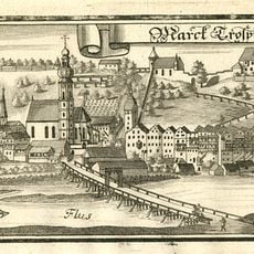
Ehem. Bauernhaus, building in Trostberg, Upper Bavaria, Germany
Location: Trostberg
Address: Johann-Namberger-Straße 31
GPS coordinates: 48.03384,12.54557
Latest update: November 24, 2023 23:45

Burg Trostberg
775 m
Feldkapelle
578 m
Katholische Kapelle St. Michael
775 m
Feldkapelle
359 m
Cultural heritage D-1-7941-0229 in Trostberg
848 m
Cultural heritage D-1-7941-0228 in Trostberg
730 m
Pflegerweg 4
812 m
Sog. Siegertschlössel
765 m
Einfriedung Siegertweg 1 in Trostberg
767 m
Martersäule aus Rotmarmor
847 m
Kapelle Marienplatz 1 in Trostberg
836 m
Vormarkt 11
825 m
Sog. Pfaukeller
820 m
Wohnhaus
840 m
Wohnhaus
823 m
Stadtmauer aus unverputztem Tuffquadermauerwerk
797 m
Wohnhaus
831 m
Ensemble
832 m
Bierkeller Traunsteiner Straße 1 in Trostberg
794 m
Wohnhaus
836 m
Vormarkt 27
837 m
Kellerhaus Traunsteiner Straße 1 in Trostberg
800 m
Wohnhaus
840 m
Wohnhaus
840 m
Wohnhaus
842 m
Sog. Schebenschlössl
772 m
Erneuertes Bauernhaus mit traufseitigem Bundwerk
134 m
Gedenkstein Vormarkt 16
850 mReviews
Visited this place? Tap the stars to rate it and share your experience / photos with the community! Try now! You can cancel it anytime.
Discover hidden gems everywhere you go!
From secret cafés to breathtaking viewpoints, skip the crowded tourist spots and find places that match your style. Our app makes it easy with voice search, smart filtering, route optimization, and insider tips from travelers worldwide. Download now for the complete mobile experience.

A unique approach to discovering new places❞
— Le Figaro
All the places worth exploring❞
— France Info
A tailor-made excursion in just a few clicks❞
— 20 Minutes