Enable Location

We need your location to show you interesting places around you

Discover nearby places

Find interesting locations and hidden gems around you

Precise directions

Get accurate directions and distances to places

Your location is never shared with other users. It's only used when you tap the location button.

Glastonbury Tor

Log in to your account

Start exploring — it's free

Trusted by 62,013 travelers worldwide

Continue with Google
Continue with Apple
or

We will send you a code to connect

By continuing, you accept our Terms and Conditions and our Privacy Policy

Check your inbox

We've sent a pincode in your inbox. Please enter the code below.

Glastonbury Tor

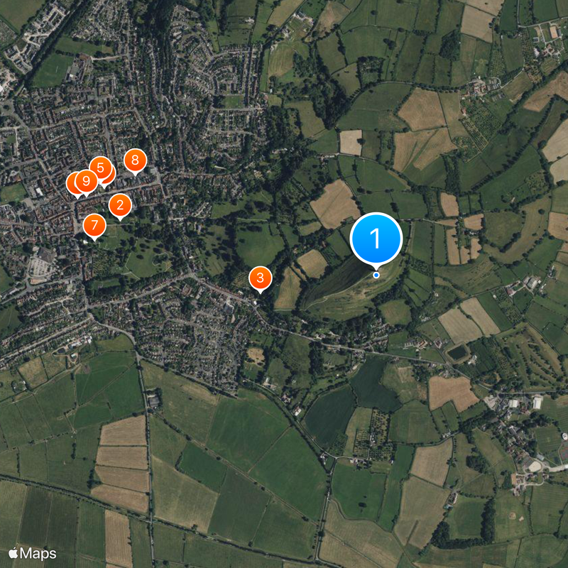
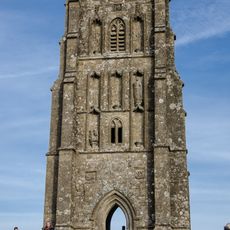
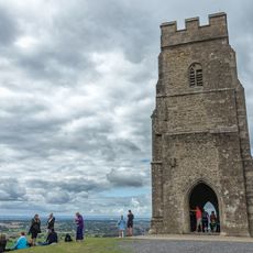
Glastonbury Tor, Medieval hill and religious site in Glastonbury, England.

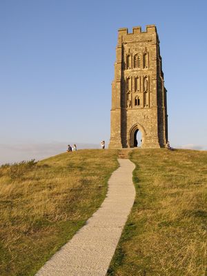
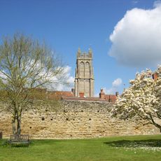
Glastonbury Tor is a 158-meter hill in Glastonbury, England, crowned by a stone tower at its summit. Seven deep terraces spiral around its slopes leading up to St Michael's Tower, which stands as the sole remnant of a medieval church.

In 1191, monks from Glastonbury Abbey claimed they discovered the graves of King Arthur and Queen Guinevere on the grounds. The current tower was built in the 14th century after an earthquake destroyed an earlier church.

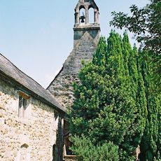
The name comes from Saint Michael, to whom the tower building on the summit is dedicated. Visitors often see candles and small offerings left at the tower walls by people expressing their wishes or prayers.

A steep path leads from the base of the hill up to the tower, with benches placed for rest along the way. The climb takes around 20 to 30 minutes and the ground can become slippery after rain, so sturdy footwear is recommended.

Archaeological evidence suggests the terraces form a three-dimensional labyrinth dating back to the Neolithic period. Some researchers believe people used this pattern for ceremonial processions, though its exact function continues to be debated.

The community of curious travelers

AroundUs brings together thousands of curated places, local tips, and hidden gems, enriched daily by 60,000 contributors worldwide.

Start exploring
Location
Elevation above the sea
158 m
GPS coordinates
51.14444,-2.69861
Latest update
December 12, 2025 21:10
Around this place
Glastonbury Abbey
United Kingdom

Glastonbury Abbey

1.2 km
Chalice Well
United Kingdom

Chalice Well

522 m
United Kingdom

Glastonbury Thorn

1.3 km
Church of St John the Baptist, Glastonbury
United Kingdom

Church of St John the Baptist, Glastonbury

1.3 km
George Hotel and Pilgrims' Inn, Glastonbury
United Kingdom

George Hotel and Pilgrims' Inn, Glastonbury

1.4 km
Abbot's Kitchen, Glastonbury Abbey
United Kingdom

Abbot's Kitchen, Glastonbury Abbey

1.3 km
Somerset Rural Life Museum
United Kingdom

Somerset Rural Life Museum

1.2 km
The Tribunal, Glastonbury
United Kingdom

The Tribunal, Glastonbury

1.3 km
St Patrick's Chapel
United Kingdom

St Patrick's Chapel

1.3 km
Church of Our Lady St Mary of Glastonbury
United Kingdom

Church of Our Lady St Mary of Glastonbury

1.3 km
Market Cross
United Kingdom

Market Cross

1.4 km
Hospital of St Mary Magdalene, Glastonbury
United Kingdom

Hospital of St Mary Magdalene, Glastonbury

1.3 km
St Benedict's Church
United Kingdom

St Benedict's Church

1.5 km
Glastonbury Town Hall
United Kingdom

Glastonbury Town Hall

1.3 km
St Andrew's Church, Edgarley
United Kingdom

St Andrew's Church, Edgarley

818 m
Glastonbury War Memorial
United Kingdom

Glastonbury War Memorial

1.3 km
Almshouses And Chapel Of St Mary Magdalene's Hospital
United Kingdom

Almshouses And Chapel Of St Mary Magdalene's Hospital

1.3 km
St Michael's Tower
United Kingdom

St Michael's Tower

31 m
43, High Street
United Kingdom

43, High Street

1.2 km
Glastonbury Abbey Precinct Wall From No.2 Silver Street To Abbey Gatehouse
United Kingdom

Glastonbury Abbey Precinct Wall From No.2 Silver Street To Abbey Gatehouse

1.3 km
Wall around grounds of Glastonbury Abbey and Abbey Retreat House, including the gate way on Chilkwell Street
United Kingdom

Wall around grounds of Glastonbury Abbey and Abbey Retreat House, including the gate way on Chilkwell Street

910 m
St Michael's Church, monastic remains, and other settlement remains on Glastonbury Tor
United Kingdom

St Michael's Church, monastic remains, and other settlement remains on Glastonbury Tor

30 m
The Abbey Retreat House
United Kingdom

The Abbey Retreat House

1 km
St George's Hall
United Kingdom

St George's Hall

1.2 km
Abbey Gatehouse,including The Porters' Lodge
United Kingdom

Abbey Gatehouse,including The Porters' Lodge

1.4 km
Old Pump House
United Kingdom

Old Pump House

1.3 km
The Abbey Barn at Abbey Farm
United Kingdom

The Abbey Barn at Abbey Farm

860 m
Milepost, Edgarley Village
United Kingdom

Milepost, Edgarley Village

432 m
Show the full map
« Glastonbury Tor - Medieval hill and religious site in Glastonbury, England » is provided by Around Us (aroundus.com). Images and texts are derived from Wikimedia project under a Creative Commons license. You are allowed to copy, distribute, and modify copies of this page, under the conditions set by the license, as long as this note is clearly visible.

Discover hidden gems everywhere you go!

From secret cafés to breathtaking viewpoints, skip the crowded tourist spots and find places that match your style. Our app makes it easy with voice search, smart filtering, route optimization, and insider tips from travelers worldwide. Download now for the complete mobile experience.

Around Us App Screenshot

A unique approach to discovering new places

Le Figaro

All the places worth exploring

France Info

A tailor-made excursion in just a few clicks

20 Minutes

Around Us
Travel Guide & Maps
Download

Send to your phone

QR Code
1

Open the camera app on your mobile.

2

Point at the QR code with your camera. A notification will appear.

3

Tap the notification to open the link.