Spinsters' Rock

Log in to your account

AroundUs is a community-driven map of interesting places, built by curious explorers like you. It grows with every review, story, and photo you share.
Connect to save your favorite spots, contribute locations, and create personalized routes.
By continuing, you accept our Terms and Conditions and our Privacy Policy
Add to collection
Map
Suggest a change
Share

Spinsters' Rock, Neolithic dolmen near Drewsteignton, United Kingdom.

Spinsters' Rock is a Neolithic burial chamber built from granite stones in Devon's countryside. Three upright pillars support and balance a large capstone that sits on top, forming an open grave structure.

The structure dates to the Neolithic period and ranks among the region's oldest buildings. It collapsed in 1862 but was reconstructed by local workers using an earlier sketch as their guide.

Local legend speaks of three wool spinners who supposedly built this stone structure before breakfast while waiting for a merchant. The tale has shaped how people know and remember this place.

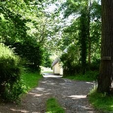
The site sits west of Drewsteignton village and is reachable on foot. Wear sturdy shoes since the ground is uneven and can be muddy in wet weather.

This is the only standing dolmen of its kind still in Devon and shows an unusual building method. The three pillars hold the massive capstone weight without mortar or additional fasteners.

Location: Drewsteignton

GPS coordinates: 50.70212,-3.84095

Latest update: December 8, 2025 21:06

Photos
Around this place
Show the full map
Castle Drogo
United Kingdom

Castle Drogo

2.2 km
Whiddonpark House
United Kingdom

Whiddonpark House

2.5 km
Providence Methodist Chapel
United Kingdom

Providence Methodist Chapel

3 km
Coach House And Stable Adjoining Rear East Corner Of Whiddonpark House
United Kingdom

Coach House And Stable Adjoining Rear East Corner Of Whiddonpark House

2.5 km
Dogmarsh Bridge
United Kingdom

Dogmarsh Bridge

1.9 km
Rushford Bridge
United Kingdom

Rushford Bridge

2.6 km
Haycroft Cottage
United Kingdom

Haycroft Cottage

2.8 km
16 And 18, Lower Street
United Kingdom

16 And 18, Lower Street

3 km
Gibhouse Cottage
United Kingdom

Gibhouse Cottage

2.2 km
10 and 12, Lower Street
United Kingdom

10 and 12, Lower Street

3.1 km
Chagford Bridge
United Kingdom

Chagford Bridge

2.9 km
The Walls, Paths And Steps Of Gardens North North East Of Castle Drogo
United Kingdom

The Walls, Paths And Steps Of Gardens North North East Of Castle Drogo

2.4 km
Pixies
United Kingdom

Pixies

576 m
Hydro-Electric Engine House At Castle Drogo
United Kingdom

Hydro-Electric Engine House At Castle Drogo

2.6 km
Sandy Park Inn
United Kingdom

Sandy Park Inn

1.6 km
East Ash Manor Including Garden Wall Adjoining To South East
United Kingdom

East Ash Manor Including Garden Wall Adjoining To South East

2.1 km
Langston Farmhouse North Including Garden Wall Adjoining To Front
United Kingdom

Langston Farmhouse North Including Garden Wall Adjoining To Front

2.8 km
Higher Gooseford Farmhouse Including Front Garden Walls Adjoining To The North-East
United Kingdom

Higher Gooseford Farmhouse Including Front Garden Walls Adjoining To The North-East

2.6 km
Bishops House
United Kingdom

Bishops House

3.1 km
Cross Fragment At Sx 678891
United Kingdom

Cross Fragment At Sx 678891

2.9 km
Langston Farmhouse (South) Including Garden Walls Adjoining To Front
United Kingdom

Langston Farmhouse (South) Including Garden Walls Adjoining To Front

2.8 km
Whiddon Park Deer Park Wall Between Sx 723 889 And Sx 722 894
United Kingdom

Whiddon Park Deer Park Wall Between Sx 723 889 And Sx 722 894

2.6 km
Stables And Coach House Garages Approximately 100 Metres North Of Castle Drogo
United Kingdom

Stables And Coach House Garages Approximately 100 Metres North Of Castle Drogo

2.2 km
Greenlands
United Kingdom

Greenlands

2 km
8, Lower Street
United Kingdom

8, Lower Street

3.1 km
7 And 9, Lower Street
United Kingdom

7 And 9, Lower Street

3.1 km
Milestone, W bound carriageway, a mile E of flyover at old Merry Meet juct of A382
United Kingdom

Milestone, W bound carriageway, a mile E of flyover at old Merry Meet juct of A382

2.3 km
Milestone, Whiddon Down, opp old café building, 100m E of campsite
United Kingdom

Milestone, Whiddon Down, opp old café building, 100m E of campsite

2.3 km
Show the full map
Reviews

Visited this place? Tap the stars to rate it and share your experience / photos with the community! Try now! You can cancel it anytime.

« Spinsters' Rock - Neolithic dolmen near Drewsteignton, United Kingdom » is provided by Around Us (aroundus.com). Images and texts are derived from Wikimedia project under a Creative Commons license. You are allowed to copy, distribute, and modify copies of this page, under the conditions set by the license, as long as this note is clearly visible.

Discover hidden gems everywhere you go!

From secret cafés to breathtaking viewpoints, skip the crowded tourist spots and find places that match your style. Our app makes it easy with voice search, smart filtering, route optimization, and insider tips from travelers worldwide. Download now for the complete mobile experience.

Around Us App Screenshot

A unique approach to discovering new places

Le Figaro

All the places worth exploring

France Info

A tailor-made excursion in just a few clicks

20 Minutes