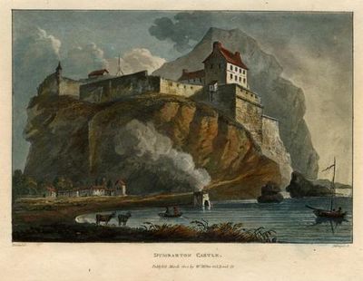
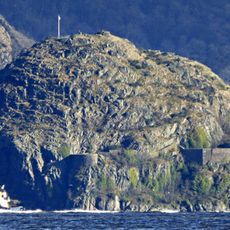
Dumbarton Castle, Medieval fortress on a volcanic rock in West Dunbartonshire, Scotland.
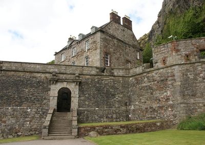
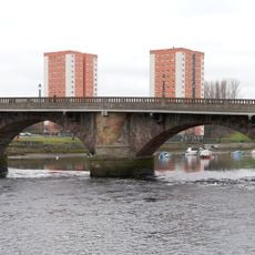
Dumbarton Castle is a fortress built on a volcanic rock at the confluence of River Clyde and River Leven in West Dunbartonshire. The site features multiple defense levels with stone fortifications that rise sharply above the water and the surrounding landscape.
The fortress served as the center of the independent Brythonic Kingdom of Strathclyde from the 5th to 9th centuries before the region faced major external pressures. The site played a key role in controlling trade routes and defending the kingdom during this formative period.
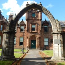
Dumbarton Castle takes its name from Scottish Gaelic 'Dùn Breatainn', meaning fortress of the Britons, reflecting its ancient Celtic past and strategic role in the region. The fortress was home to the royal court and served as a power center for the kingdom that once dominated these lands.
Visit during the warmer months when the site is regularly open and pathways are dry and accessible for exploration. The grounds are hilly with stairs in several areas, so wear sturdy footwear to navigate the terrain comfortably.
The castle rock served as the primary reference point for Ordnance Survey maps of Dumbartonshire until 1919, making it essential for regional mapping. Cartographers relied on this peak to anchor their measurements and position all other locations in the area accurately.
Location: West Dunbartonshire
Website: https://historicenvironment.scot/visit-a-place/places/dumbarton-castle
GPS coordinates: 55.93600,-4.56280
Latest update: December 14, 2025 18:39
Overtoun Bridge
3 km
Overtoun House
3 km
Finlaystone House
3.6 km
Dalmoak House
3.1 km
Formakin House
3.6 km
Ingliston Country Club & Hotel
3.2 km
Dumbarton, Church Street, Burgh Hall
918 m
Dumbarton, Church Street, Sheriff Court
973 m
Dumbarton, Church Street, Municipal Buildings
1.1 km
Dumbarton Collegiate Church
1.3 km
County Buildings, Dumbarton
1.8 km
Hartfield House, Dumbarton
1.3 km
Dumbarton Ship Model Experiment Tank
802 m
St Augustine’s Episcopal Church
907 m
Riverside Parish Church
815 m
Levenford House
1.4 km
The Denny Ship Model Experiment Tank
826 m
Public House, 1 Station Road, Dumbarton
1.2 km
Dumbarton, Church Street, Municipal Buildings, Peter Denny Statue
1.1 km
Dumbarton, Strathleven Place, Drumoyne
1.1 km
Dumbarton Cemetery
1.9 km
2 Station Road, Dumbarton
1.2 km
Dumbarton, Strathleven Place, St Patrick's Roman Catholic Church
1.1 km
Dumbarton Castle
84 m
Dumbarton, High Street, Glencairn Tenement
952 m
Dumbarton Bridge
1.2 km
Dumbarton, Church Street, Municipal Buildings, College Bow
1.1 km
Dalreoch railway bridge
1.4 kmVisited this place? Tap the stars to rate it and share your experience / photos with the community! Try now! You can cancel it anytime.
Discover hidden gems everywhere you go!
From secret cafés to breathtaking viewpoints, skip the crowded tourist spots and find places that match your style. Our app makes it easy with voice search, smart filtering, route optimization, and insider tips from travelers worldwide. Download now for the complete mobile experience.
A unique approach to discovering new places❞
— Le Figaro
All the places worth exploring❞
— France Info
A tailor-made excursion in just a few clicks❞
— 20 Minutes