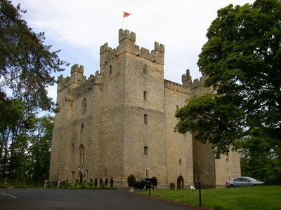
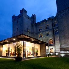
Langley Castle, Medieval castle in Haydon, England
Langley Castle is a stone fortress in the South Tyne valley with four distinctive corner towers rising four floors high. The building has a characteristic H-shaped layout constructed entirely of stone to provide strength and durability.
Sir Thomas de Lucy commissioned the fortress in 1364 after an earlier manor house on the site had been destroyed. The structure played a role in securing this border region against raids and incursions over the following centuries.
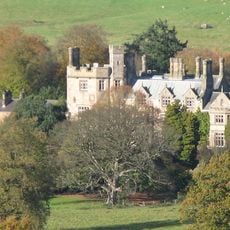
The castle was built as a defensive stronghold for the border region and served as home to a local noble family for centuries. Its medieval stone towers and layout remain part of the valley's identity, reflecting how fortified homes shaped life in this remote area.
The building stands about 3 miles south of Haydon Bridge within a wooded estate covering about 10 acres of grounds. Visitors should prepare for uneven terrain as the property sits on a hillside and sturdy footwear is advised.
The south tower contains twelve toilets spread across four levels, revealing how castles of the 1300s handled sanitation. This detail remains unusually well preserved and makes the fortress a significant example of medieval engineering and cleanliness.
The community of curious travelers
AroundUs brings together thousands of curated places, local tips, and hidden gems, enriched daily by 60,000 contributors worldwide.