Apedale Community Country Park, Country park in Newcastle-under-Lyme, England.
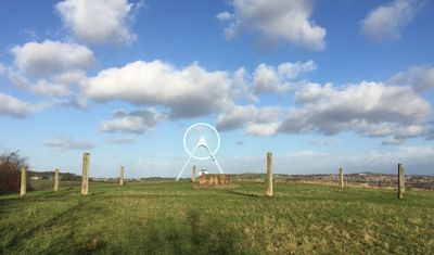
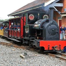
Apedale Community Country Park is a public landscape park built on former coal mining land, with extensive woodland, ponds, and open grassland spread across its reclaimed grounds. The 454-acre site features numerous walking paths and an operating narrow gauge railway with restored mining locomotives.
The site was the location of active coal mining with several pits operating until they closed in the later part of the 20th century, after which the land was gradually restored. This transformation demonstrates how industrial landscapes can be reclaimed and returned to public use.
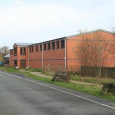
The heritage center within the park tells the story of coal mining in the region and keeps alive memories of how this industry shaped the local community. Visitors can learn how central mining was to people's lives and work in this area.
The park has well-marked paths suitable for different activity levels and parking available at entry points. Information boards positioned throughout help visitors navigate the different areas and understand what they are seeing.
The Apedale Valley Light Railway, a narrow gauge railway with restored mining locomotives, operates through the park and offers rides on the former mine tracks. This working railway gives visitors a direct sense of how coal was once transported from the site.
The community of curious travelers
AroundUs brings together thousands of curated places, local tips, and hidden gems, enriched daily by 60,000 contributors worldwide.