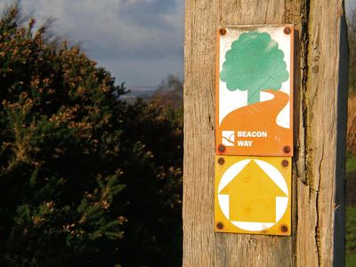
Beacon Way, Long-distance footpath in Brecon Beacons National Park, Wales
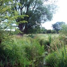
Beacon Way is a long-distance walking route spanning roughly 160 km through the Brecon Beacons National Park, connecting mountain peaks with valleys and lower terrain. The path moves through varied landscapes, from open ridges and moorland to woodland and river valleys.
The route was created in 2005, linking existing walking paths into one continuous long-distance trail. It brought together established routes that previously existed separately, forming a new way to cross the entire national park.
The route passes Welsh historical sites where visitors can see traces of medieval settlement and defense, including castles and hillforts scattered across the landscape. These places reveal how people once used the mountains and shaped the terrain over centuries.
The path has limited markings in some sections and requires good navigation skills and proper equipment for changeable mountain weather. Walkers should carry maps and a compass or use GPS, as conditions can shift rapidly and fog often obscures the way ahead.
The route includes alternative lower-level paths beneath the Black Mountain escarpment, allowing walkers to choose different elevation options during their journey. This flexibility makes it possible to adjust the difficulty depending on weather or fitness levels.
The community of curious travelers
AroundUs brings together thousands of curated places, local tips, and hidden gems, enriched daily by 60,000 contributors worldwide.