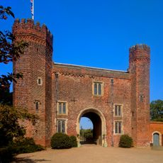
Blyth Priory, Benedictine priory in Blyth, England
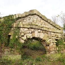
Blyth Priory was a Benedictine monastery with remains showing architectural features from the 11th century built in Norman style. The archaeological remains now lie beneath a housing development in the village of Blyth, Nottinghamshire.
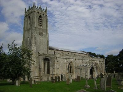
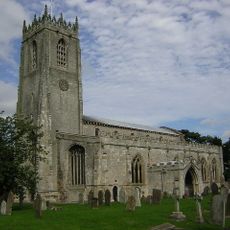
A Norman nobleman named Roger de Busli founded the monastery in 1088 and connected it to a French abbey in Rouen. Following the dissolution of the monasteries, the church was converted to serve as a parish church.
The site served as a spiritual center where monks performed daily prayers and the local population participated in religious life. This role shaped village life for centuries.
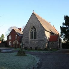
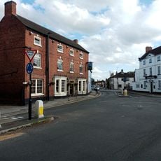
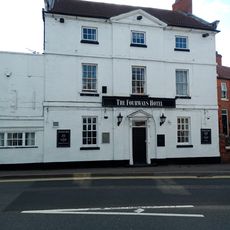
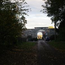
The site is now a protected monument with remains hidden beneath modern buildings, making them difficult to see from ground level. The nearest visible structure is the parish church of St. Mary and St. Martin, which visitors can access.
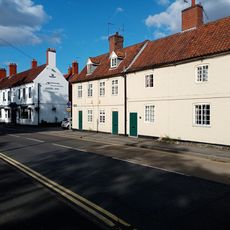
The original monastery church was rebuilt as today's parish church after the dissolution and still contains parts of the original Norman architecture. Visitors can discover traces of this medieval past still visible in the building.
Location: Blyth
Inception: 1088
GPS coordinates: 53.37880,-1.06346
Latest update: December 13, 2025 12:41
Hodsock Priory
2.3 km
Serlby Hall
2.5 km
St. Mary and St. Martin’s Church, Blyth
5 m
Hermeston Hall
3.6 km
St Luke's Church, Langold
3.8 km
St Mark's Church
3.9 km
Church of St Helen
3.5 km
The Angel Inn
130 m
Wesleyan Chapel
3.5 km
Blyth And Hodsock War Memorial
735 m
Oldcotes War Memorial
3.9 km
Arch
2.7 km
The Red Hart Hotel
184 m
Fourways Hotel
183 m
Langold War Memorial
3.7 km
Blyth New Bridge
671 m
Range Of Farm Buildings At Manor Farm
3.4 km
Genever Butchers
160 m
Milestone 90 Metres South Of Ivy Cottages
171 m
Hodsock Priory Gatehouse and Bridge
2.2 km
Old Angel Row
148 m
Angel Row
130 m
White House Cafe
265 m
Enclosure And Outbuildings To Farmyard At Hodsock Grange
3.7 km
East Lodge
3.3 km
Manor Farm Farmhouse
3.4 km
Old Angel Row
143 m
Milepost, N of track to Goldthorpe Farm; between Oldcotes (A634 jct) and Langold
3.7 kmVisited this place? Tap the stars to rate it and share your experience / photos with the community! Try now! You can cancel it anytime.
Discover hidden gems everywhere you go!
From secret cafés to breathtaking viewpoints, skip the crowded tourist spots and find places that match your style. Our app makes it easy with voice search, smart filtering, route optimization, and insider tips from travelers worldwide. Download now for the complete mobile experience.
A unique approach to discovering new places❞
— Le Figaro
All the places worth exploring❞
— France Info
A tailor-made excursion in just a few clicks❞
— 20 Minutes