Dinedor Camp

Log in to your account

AroundUs is a community-driven map of interesting places, built by curious explorers like you. It grows with every review, story, and photo you share.
Connect to save your favorite spots, contribute locations, and create personalized routes.
Continue with Google
Continue with Apple
Continue with X
Continue with Facebook
Continue with email
By continuing, you accept our Terms and Conditions and our Privacy Policy
Create an account
Add to collection
Map
Suggest a change
Share

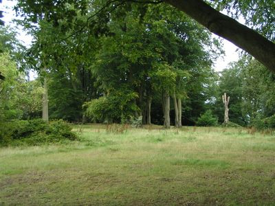
Dinedor Camp, Iron Age hillfort in Dinedor, England.

Dinedor Camp is an Iron Age fortified settlement built on elevated ground and surrounded by substantial earthen ramparts that form a defensive perimeter. The site occupies a large area and integrates natural slopes into its structure, creating a layered defensive design.

This fortified settlement was established during the Iron Age as a defensive residence and reflects the engineering skill of that time. Archaeological investigations have uncovered pottery, metal tools, and household items that reveal details about the daily lives of those who lived here.

The earthwork formation demonstrates the technical knowledge of Iron Age communities in selecting and modifying elevated positions for settlement and defense purposes.

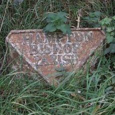
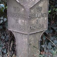
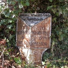
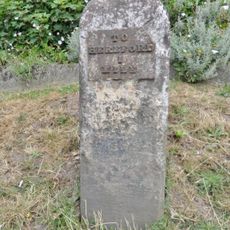
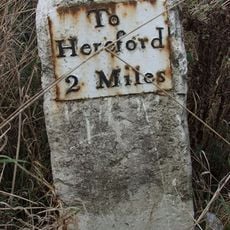
The site is freely accessible and located a few kilometers south of Hereford, reached by walking paths from nearby residential areas. Sturdy footwear is recommended as the ground is uneven and mostly covered with grass.

The eastern entrance features outward-turning walls that show clever defensive planning. This unusual arrangement is rarely seen in similar sites and catches the eye of those exploring the perimeter.

Location: Dinedor

GPS coordinates: 52.02350,-2.69588

Latest update: December 14, 2025 14:21

Photos
Around this place
Victoria Bridge, Hereford
United Kingdom

Victoria Bridge, Hereford

3.3 km
Rotherwas Chapel
United Kingdom

Rotherwas Chapel

2.4 km
Former Church of St John the Baptist
United Kingdom

Former Church of St John the Baptist

2.9 km
Church of St Peter
United Kingdom

Church of St Peter

1.5 km
Church of St Andrew
United Kingdom

Church of St Andrew

1.1 km
Church of St Martin
United Kingdom

Church of St Martin

2.9 km
Rotherwas Women
United Kingdom

Rotherwas Women

1.7 km
Milepost At Junction Of Hampton Park Road And St Margarets Road
United Kingdom

Milepost At Junction Of Hampton Park Road And St Margarets Road

2.9 km
Bullingham Old Church
United Kingdom

Bullingham Old Church

1.5 km
SAS memorial sculpture
United Kingdom

SAS memorial sculpture

2.2 km
Church of St James
United Kingdom

Church of St James

3.1 km
A Fish's Eye View
United Kingdom

A Fish's Eye View

3.3 km
St Giles' Chapel (Off St Giles Hospital)
United Kingdom

St Giles' Chapel (Off St Giles Hospital)

3.4 km
The Thatch
United Kingdom

The Thatch

3 km
Holme Lacy House
United Kingdom

Holme Lacy House

3.4 km
Bullinghope War Memorial
United Kingdom

Bullinghope War Memorial

1.5 km
Milepost At So553381
United Kingdom

Milepost At So553381

3.3 km
Milepost, S of Lower Bullingham
United Kingdom

Milepost, S of Lower Bullingham

1.3 km
Milepost, W of Industrial estate; 200m from railway bridge
United Kingdom

Milepost, W of Industrial estate; 200m from railway bridge

1.8 km
Milepost, Hampton Park Road, Franchise Stone
United Kingdom

Milepost, Hampton Park Road, Franchise Stone

3.1 km
Milepost, Park Farm; 15m W farm entrance
United Kingdom

Milepost, Park Farm; 15m W farm entrance

2 km
Milepost, Bullingham, by LH entrance to Fairbrook House
United Kingdom

Milepost, Bullingham, by LH entrance to Fairbrook House

857 m
Milestone, Ross Road, jct Holme Lacey Road outside The Broadleys PH
United Kingdom

Milestone, Ross Road, jct Holme Lacey Road outside The Broadleys PH

2.8 km
Milestone, Redhill Bridge, Ross Road
United Kingdom

Milestone, Redhill Bridge, Ross Road

1.9 km
Milestone, Portway; N of  village
United Kingdom

Milestone, Portway; N of village

2.6 km
Milepost, Holme Lacy Road, by The Broadleys P.H., St Martin's, W of Putson
United Kingdom

Milepost, Holme Lacy Road, by The Broadleys P.H., St Martin's, W of Putson

2.8 km
Milepost, Eign Hill, W of Hampton Park, E of railway
United Kingdom

Milepost, Eign Hill, W of Hampton Park, E of railway

2.8 km
Milepost, Barry's Cross
United Kingdom

Milepost, Barry's Cross

1.7 km
Show the full map
Reviews

Visited this place? Tap the stars to rate it and share your experience / photos with the community! Try now! You can cancel it anytime.

« Dinedor Camp - Iron Age hillfort in Dinedor, England » is provided by Around Us (aroundus.com). Images and texts are derived from Wikimedia project under a Creative Commons license. You are allowed to copy, distribute, and modify copies of this page, under the conditions set by the license, as long as this note is clearly visible.

Discover hidden gems everywhere you go!

From secret cafés to breathtaking viewpoints, skip the crowded tourist spots and find places that match your style. Our app makes it easy with voice search, smart filtering, route optimization, and insider tips from travelers worldwide. Download now for the complete mobile experience.

Around Us App Screenshot

A unique approach to discovering new places

Le Figaro

All the places worth exploring

France Info

A tailor-made excursion in just a few clicks

20 Minutes