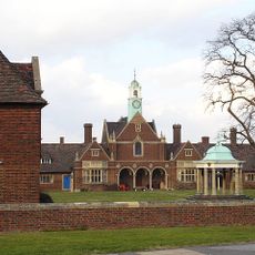
Fort Clarence, Military fort in Rochester, England
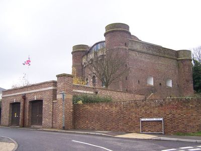
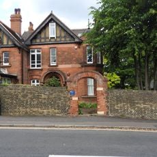
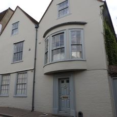
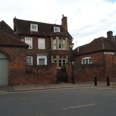
Fort Clarence is a military fortification in Medway featuring a substantial red brick tower with firing openings and a deep dry ditch for defensive purposes. The central structure has since been converted into residential apartments while portions of the surrounding ditch remain visible.
The fort was built between 1808 and 1812 during the Napoleonic Wars as part of a defense network protecting the River Medway and Chatham Dockyard. It underwent several changes in purpose over the following decades, serving military and civilian needs.
The fort held meaning for local people as a symbol of protection during uncertain times, and its presence shaped how residents thought about safety and defense. The structure became woven into the identity of the Medway area and remains a landmark that connects people to their region's past.
The fort sits in an urban area and is visible from the surrounding streets, though interior access may be restricted due to its current residential use. Visitors can view the exterior structure and the ditch from outside to appreciate the original fortification design.
The fort contains an underground tunnel network connecting the main structure to outlying guardhouses. These hidden passages allowed soldiers to move supplies and ammunition throughout the complex while staying sheltered from above.
Location: Medway
Inception: 1808
GPS coordinates: 51.38156,0.49756
Latest update: December 12, 2025 12:05
St. Margaret's Church
401 m
St Margaret's Cemetery Chapels
560 m
Tomb Chest North Of Nave Of St Margaret's Church
416 m
Group Of Four Tomb Chests Immediately East Of St Margaret's Church
409 m
Tomb Chest 15 Metres North West Of St Margaret's Church
419 m
The Limes And Garden Wall To North Attached
527 m
Wellesley House
584 m
Wingham Lodge
505 m
Wall With Gates Enclosing Churchyard Of St Margaret's Parish Church With Headstones Attached
370 m
Grayling House
516 m
Watts' Almshouses
298 m
Morden Terrace
357 m
36 And 38, St Margaret's Street
590 m
32, St Margaret's Street
600 m
Foord Almshouses
493 m
23 And 25, St Margaret's Street
560 m
34, St Margaret's Street
596 m
65 And 67, Maidstone Road
565 m
55 And 57, Maidstone Road
585 m
Nos 1-47, Cupola In Centre Court, Foord Almshouses Nos 48-64, 1-47
590 m
61 And 63, Maidstone Road
573 m
St Ronans
522 m
Candlemas House
576 m
Foord Almshouses Nos 1-47 With Gate And Forecourt Walls Attached
557 m
Gazebo At Foot Of Garden To Rear Of No 52 Gazebo At Foot Of Garden To Rear Of The Limes
544 m
No 50 With Front Garden Walls And Gatepiers Attached
550 m
Thorndikes And Former Stable And Coach House Adjoining
440 m
Two Tomb Chests 8 Metres North Of Nave Of St Margaret's Church
415 mVisited this place? Tap the stars to rate it and share your experience / photos with the community! Try now! You can cancel it anytime.
Discover hidden gems everywhere you go!
From secret cafés to breathtaking viewpoints, skip the crowded tourist spots and find places that match your style. Our app makes it easy with voice search, smart filtering, route optimization, and insider tips from travelers worldwide. Download now for the complete mobile experience.
A unique approach to discovering new places❞
— Le Figaro
All the places worth exploring❞
— France Info
A tailor-made excursion in just a few clicks❞
— 20 Minutes