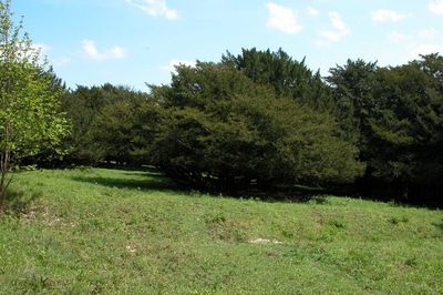
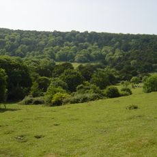
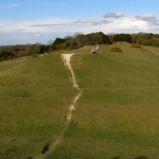
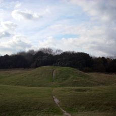
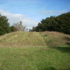
Goosehill Camp, Iron Age hillfort in West Dean, England
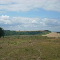
Goosehill Camp is a prehistoric fortified settlement on Bow Hill featuring two concentric banks with ditches that create multiple enclosed defensive rings. The earthworks show how people structured their living space for protection during the Iron Age.
The settlement dates to the Iron Age when people transformed hilltops into fortified strongholds. A systematic excavation in the 1950s with help from school students uncovered the ancient layout of dwellings within the enclosures.
The settlement pattern and structural design of Goosehill Camp provide evidence of social organization and territorial management during prehistoric Britain.
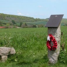
The site sits within a protected nature reserve and is accessible on foot from nearby parking areas. Good footwear is essential since the ground is uneven and walking crosses grass and earth.
Modern scanning technology has revealed hidden traces including two possible dwelling locations within the inner enclosure that earlier digging never found. This shows how new tools can uncover details that traditional excavation methods might easily miss.
Location: West Dean
GPS coordinates: 50.90704,-0.82195
Latest update: December 14, 2025 09:47
Weald and Downland Living Museum
4.5 km
Monkton House
4.8 km
Kingley Vale National Nature Reserve
2.5 km
West Dean House
3.2 km
Devil's Humps, Stoughton
1.9 km
Devil's Jumps
4.7 km
Weald and Downland Gridshell
4.6 km
West Dean Gardens
3.7 km
Villa rustica of Chilgrove - 1
544 m
Church of St Nicholas
4.8 km
Church of St Mary
4.2 km
The Parish Church of St Mary
3 km
Church of St Michael
3.7 km
Church of St Peter
3 km
The Parish Church of St Andrew
3.2 km
Binderton Chapel
2.9 km
Church of St Andrew
3.9 km
The Summerhouse Of West Dean Park In The Former Kitchen Garden To The North East Of The House, Now Part Of Home Farm
3.4 km
99, 100 And 102, Park Lane
2.9 km
The Lodge, Gateway And Entrance Walls Of West Dean Park To The North East Of The House
3.4 km
Former Singleton Railway Station
3.8 km
Hptm J. Oestermann Memorial, Treyford
4.6 km
Two bell barrows, two pond barrows and a cross dyke on Bow Hill: part of The Devil's Humps round barrow cemetery
1.9 km
119 And 120, Chichester Road
3.5 km
The Village Well Head And Pump
3 km
Palm House 50 Metres To North Of Main Building
3.3 km
Two bowl barrows on Bow Hill forming part of The Devil's Humps round barrow cemetery
1.7 km
Plt Off B. Własnowolski Memorial, Stoughton, West Sussex
2.9 kmVisited this place? Tap the stars to rate it and share your experience / photos with the community! Try now! You can cancel it anytime.
Discover hidden gems everywhere you go!
From secret cafés to breathtaking viewpoints, skip the crowded tourist spots and find places that match your style. Our app makes it easy with voice search, smart filtering, route optimization, and insider tips from travelers worldwide. Download now for the complete mobile experience.
A unique approach to discovering new places❞
— Le Figaro
All the places worth exploring❞
— France Info
A tailor-made excursion in just a few clicks❞
— 20 Minutes