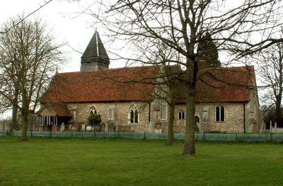
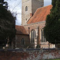
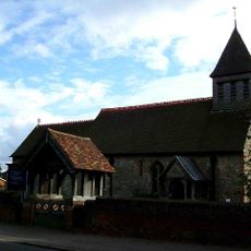
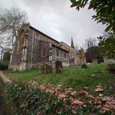
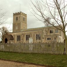
Old St Mary's Church, West Bergholt, Grade I listed Anglican church in West Bergholt, England.
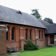
Old St Mary's Church is an Anglican church in West Bergholt with masonry from around 1000 in its north wall, incorporating Roman bricks in the walls and buttresses. The building displays Anglo-Saxon construction techniques and has been preserved as a stone structure over the centuries.
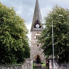
The building served as the main religious center until 1904, when population changes led to the construction of a new St Mary's Church closer to the village. The old church then lost its primary function but remained standing as a historical structure.
The church displays royal coats of arms, including a rare example from the reign of James I and a cast iron piece from 1816 made at a Colchester foundry.
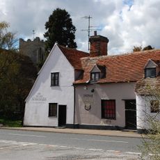
The church is located about three miles northwest of Colchester along the B1508 road and is accessible to visitors during opening hours. Plan your visit during daylight hours as this is the best time to see the building's architecture and details clearly.
The north wall contains original Anglo-Saxon masonry dating to around 1000, making this one of the oldest church walls in Essex. Few visitors realize that such early stone structures are rare in this region and reveal much about medieval building techniques.
Location: West Bergholt
Inception: 1000
Architectural style: Anglo-Saxon architecture
Website: http://visitchurches.org.uk/Ourchurches/Completelistofchurches/St-Marys-Church-West-Bergholt-Essex
GPS coordinates: 51.91710,0.83840
Latest update: December 14, 2025 18:12
Lexden Gathering Grounds
2.9 km
Church of All Saints
2.5 km
Iron Latch
2.2 km
Westhouse Wood
2.3 km
Parish Church of St Albright
4 km
Church of St John
3 km
Church of St Leonard
3.5 km
Church of St Peter and St Paul
3.9 km
All Saints Church
2.6 km
St Michael's Church
3.7 km
Westwood Park (old Peoples Home)
2.1 km
The Shoulder Of Mutton Public House
3.4 km
The Three Horseshoes Public House
2.5 km
West Bergholt Hall
73 m
Cooks Hall
782 m
Fordham war memorial
2.5 km
Beaconhead Farmhouse
3.3 km
The White Hart Public House
738 m
The Queen's Head Public House
3.4 km
Catchbells
3.9 km
Moat Farm Dyke: a northern extension of Lexden Dyke; part of the Iron Age territorial oppidum and Romano-British town of Camulod
2.9 km
Kings Farmhouse
3.7 km
Jenkins Farmhouse
3.4 km
Milestone, Nayland Road, West Bergholt
968 m
Milestone, London Road, Knights Farm
2.5 km
Milestone, Lexden Road
3.3 km
Milestone, Milestone Farm, Halstead Road
2.6 km
Milestone, London Road, Mounts Farm
3.9 kmVisited this place? Tap the stars to rate it and share your experience / photos with the community! Try now! You can cancel it anytime.
Discover hidden gems everywhere you go!
From secret cafés to breathtaking viewpoints, skip the crowded tourist spots and find places that match your style. Our app makes it easy with voice search, smart filtering, route optimization, and insider tips from travelers worldwide. Download now for the complete mobile experience.
A unique approach to discovering new places❞
— Le Figaro
All the places worth exploring❞
— France Info
A tailor-made excursion in just a few clicks❞
— 20 Minutes