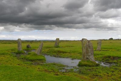
Nine Stones, Stone circle in Altarnun, England.
Nine Stones is a stone circle located near Altarnun on Bodmin Moor in Cornwall, measuring approximately 49 feet (15 meters) across and comprising nine granite blocks. The arrangement centers around a central standing stone with the others positioned around it.
The stone circle dates to the Bronze Age and stands among many prehistoric monuments across Bodmin Moor. In 1889, it underwent restoration when only two stones remained standing, requiring the repositioning of the others.
This circle served as a gathering place where ancient communities likely performed ceremonies and observed the movements of stars and sun. The arrangement of stones suggests the site held both ritual and social importance for Bronze Age people.
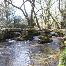
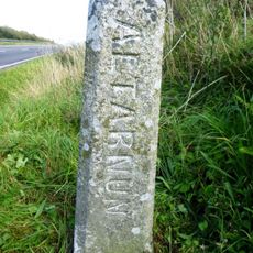
The site sits on open moorland accessible on foot, with the final approach along rough terrain and tracks. Limited parking is available near a farm north of North Hill, reached by crossing a cattle grid on the signposted Bastreet road.
The stones in the circle lean at varying angles, creating an uneven arrangement particularly noticeable with the central granite post standing about 1.1 meters (3.6 feet) high. This tilting may reflect intentional placement by the builders or the result of natural settling over thousands of years.
Location: Altarnun
GPS coordinates: 50.57630,-4.49258
Latest update: December 12, 2025 17:48
St Nonna's Church, Altarnun
3.5 km
Altarnun Methodist Chapel
3.2 km
Kings Head Hotel
2.8 km
Church of St Torney
3.9 km
Altarnun Old Bridge
3.4 km
Milestone To North East Of High Park Lodge
2.9 km
Milestone 100 Metres To South East Of Kings Head Hotel
2.7 km
Milestone 80 Metres To South West Of Strylands
2.3 km
Milestone On N Side Of B3257, Circa 33M Nw Of Cleth Cottage
3.4 km
Milestone On A30 Slip Road To Lewannick (Ngr Sx2668881285)
4.4 km
Berriowbridge Bridge
4.5 km
Three medieval wayside crosses 70m SW of Trebartha Hall
2.7 km
Milestone 200 Metres To East Of Plusha
2.7 km
Milestone 500 Metres To West Of Trefursdon
4.2 km
Footbridge 90 Metres To South-East Of Trevague
1.4 km
Milestone 500 Metres To North East Of Plusha
3 km
Milestone 250 Metres North East Of Trenhorne
4.3 km
Boundary Stone 220 Metres To North East Of Higher Cannaframe Farm
3.7 km
Milestone 650 Metres To North West Of North Hill Village
3.2 km
Medieval wayside cross in Altarnun churchyard
3.4 km
Milestone 450 Metres To North Of Trewithey
4.5 km
Cross 20 Metres To South East Of Trekennick Farmhouse
3.9 km
Chygrysys
3.3 km
Milestone 800 Metres To South West Of Trewint Marsh
3 km
Early post-medieval guide post 270m north west of Bowden
4.5 km
Trevadlock Manor And Garden Walls To North
3 km
Milestone 160 Metres To North Of East Berriow
4.4 km
Guidestone, Trebatha, in grounds
2.7 kmVisited this place? Tap the stars to rate it and share your experience / photos with the community! Try now! You can cancel it anytime.
Discover hidden gems everywhere you go!
From secret cafés to breathtaking viewpoints, skip the crowded tourist spots and find places that match your style. Our app makes it easy with voice search, smart filtering, route optimization, and insider tips from travelers worldwide. Download now for the complete mobile experience.
A unique approach to discovering new places❞
— Le Figaro
All the places worth exploring❞
— France Info
A tailor-made excursion in just a few clicks❞
— 20 Minutes