Penwortham Castle, Medieval castle ruins in Penwortham, England.
Description
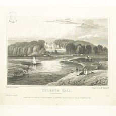
Penwortham Castle is a Norman fortification located on the south bank of the River Ribble, with a motte (earthwork mound) standing as its main surviving feature. This raised earthwork once formed part of a larger defensive structure that controlled this important river crossing.
History
Roger of Poitou built the castle following the Norman conquest to protect a strategic ford and river crossing. The fortification served as a center of Norman control in this region near the Ribble estuary.
Culture
The castle site, recorded in the Domesday Book of 1086, maintained a community of burgesses, riding men, villeins, and cattle keepers.
Practical
The site can be reached through public pathways that lead to the motte, which remains the primary feature to explore. Wear sturdy footwear as the ground can be uneven and muddy, particularly after rain.
Did you know?
The castle appears in the Domesday Book of 1086, recorded as a settlement with a community of merchants, farmers, and livestock keepers. This entry reveals that the site was already an established center of commerce and daily life.
AroundUs brings together thousands of curated places, local tips, and hidden gems, enriched daily by 60,000 contributors worldwide. Discover all places nearby (Penwortham).
Preston railway station
1 km
Church of St. Walburge, Preston
935 m
St Joseph's Orphanage
1.2 km
County Hall, Preston
885 m
Park Hotel
1.2 km
Odeon Preston
559 m
St Mark's Church, Preston
836 m
Tulketh Hall
1.1 km
St Peter's Church
1.3 km
St Mary's Church, Penwortham
85 m
Fishergate Baptist Church
1.2 km
St Michael and All Angels Church, Ashton-on-Ribble
1.2 km
Penwortham Bridge
962 m
The Guild
1.2 km
Derby Monument
1.2 km
Vicars Bridge, Preston
1.2 km
Former Moss Mill
1.2 km
Fishergate Bridge
994 m
Fylde Road Viaduct
1.1 km
88,89, Fishergate Hill
716 m
Railway Viaduct Over River Ribble
1.3 km
12-18, Spring Bank
747 m
Hosiery House
1.1 km
Terrace Steps With Balustrades And Urns In Centre Of Upper Terrace
1.3 km
Tomb chest
83 m
Main Block To St Wilfrids Roman Catholic School
1.3 km
7,8, Spring Bank
709 m
9,10,11, Spring Bank
730 mDiscover hidden gems everywhere you go!
From secret cafés to breathtaking viewpoints, skip the crowded tourist spots and find places that match your style. Our app makes it easy with voice search, smart filtering, route optimization, and insider tips from travelers worldwide. Download now for the complete mobile experience.
A unique approach to discovering new places❞
— Le Figaro
All the places worth exploring❞
— France Info
A tailor-made excursion in just a few clicks❞
— 20 Minutes