Prawle Point, Maritime headland in Chivelstone, England
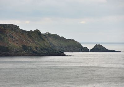
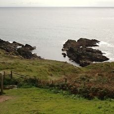
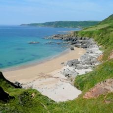
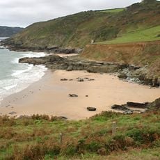
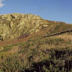
Prawle Point is a cape at the southernmost tip of Devon, marked by high cliffs made of volcanic rock over 400 million years old. The coastline drops sharply to the English Channel and offers wide views across the water from the headland.
The name comes from Old English 'Prǣwhyll', meaning 'lookout hill', reflecting its role as a monitoring point since Saxon times. This location has been used as a strategic observation post since the early medieval period.
The observation station is run by volunteers who watch ships passing through the English Channel, continuing a long tradition of coastal monitoring. This work is deeply tied to how local people connect with their marine surroundings.
Access to Prawle Point comes via a single-track road from East Prawle village, leading to a National Trust car park. From there, the cliffs and observation area are easily reached on foot.
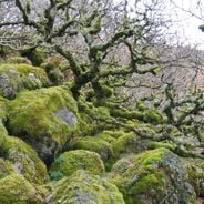
The soft cliffs here are home to over 100 species of solitary bees and wasps, including the rare cuckoo bee Nomada sexfasciata found nowhere else in Britain. This specialized insect population thrives in the cliff crevices and nesting spaces.
Location: Chivelstone
GPS coordinates: 50.20170,-3.72194
Latest update: December 6, 2025 19:10
Devon combines historical sites and natural landscapes across a region in southwest England. The area extends from moorlands in Dartmoor National Park to cliffs along the Bristol Channel and English Channel coasts. Visitors find Norman castle ruins like Totnes Castle and Okehampton Castle, Georgian...
Overbeck's
4.9 km
Salcombe Castle
4.9 km
Church of St Sylvester
4 km
Church of St Winaloe
4.1 km
Ham Stone
1.5 km
Mattiscombe Sands
4.9 km
The Ferry Inn
5 km
Outbuilding In Grounds Of Marine Hotel To South
5 km
Former Look Out Tower Incorporated With Tower House At Corner Of Newton Road
5.1 km
Lannacombe Beach
3.8 km
Gara Rock beach
2.5 km
46 Bakerswell
5 km
Salcombe Library
5 km
Salcombe War Memorial and Shelter
5 km
Old Watch House
5 km
Ferry View, Ferry Steps And Nos. 50-51
5 km
End House
5 km
54 And 55, Fore Street
5 km
47 Bakerswell
5 km
The Dower House
5 km
Little End
5 km
57-59, Fore Street
5.1 km
56, Fore Street
5.1 km
Ferry View
5 km
Sleepy Thatch, Sunny Thatch, Vine Cottage And No. 4 Vine Cottage
1.8 km
Woodcot
5 km
The Grange
5 km
Coaxial field system and semaphore station at Signal House Point
504 mVisited this place? Tap the stars to rate it and share your experience / photos with the community! Try now! You can cancel it anytime.
Discover hidden gems everywhere you go!
From secret cafés to breathtaking viewpoints, skip the crowded tourist spots and find places that match your style. Our app makes it easy with voice search, smart filtering, route optimization, and insider tips from travelers worldwide. Download now for the complete mobile experience.
A unique approach to discovering new places❞
— Le Figaro
All the places worth exploring❞
— France Info
A tailor-made excursion in just a few clicks❞
— 20 Minutes