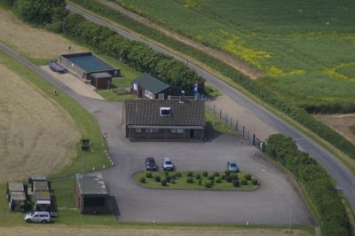
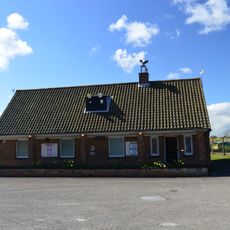
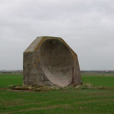
RAF Holmpton, Cold War radar bunker in Patrington, England.
RAF Holmpton is an underground military complex in Patrington with command centers, monitoring stations, and radar equipment positioned well below ground level. The structure contains multiple levels with separate rooms designed for different operational tasks like communication, observation, and data processing.
The facility was built in the 1950s as part of Britain's air defense strategy against Soviet threats and remained operational until the early 2000s. Its construction followed a larger national program to establish monitoring posts across the country.
The site reveals how Britain organized its defense during the Cold War, with military personnel and equipment working together to monitor threats. Visitors can see the actual workspaces where operators and technicians spent their shifts watching for danger.
Visitors can take guided tours through the underground rooms to see original military installations, which typically takes several hours to complete. It is advisable to wear comfortable shoes and prepare for narrow staircases and cooler temperatures below ground.
The facility was notable for combining several radar functions in one location rather than spreading them across different sites, which was an unusual approach at the time. This innovative design later served as a model for similar installations built in other European nations.
The community of curious travelers
AroundUs brings together thousands of curated places, local tips, and hidden gems, enriched daily by 60,000 contributors worldwide.