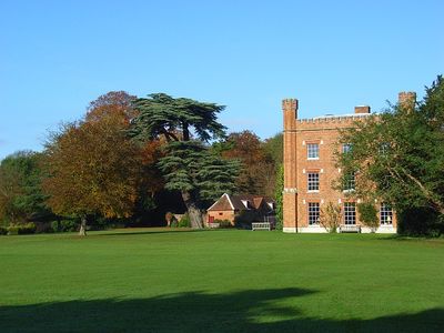
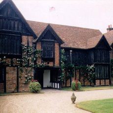
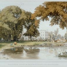
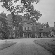
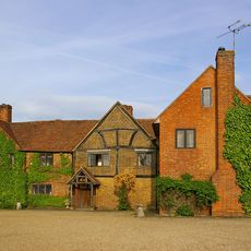
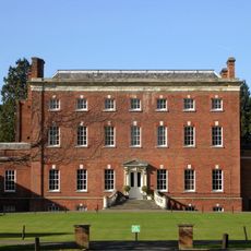
Shottesbrooke Park, English country house in Shottesbrooke, England
Shottesbrooke Park is a country house that originated in the 16th century but underwent substantial alterations during the late 18th and early 19th centuries. The building combines Tudor elements with later modifications that reflect changing architectural tastes over time.
Henry Powle, a prominent 17th-century politician, established his residence on the estate. Later modifications to the house show how country estates were adapted to reflect new architectural standards of the Georgian period.
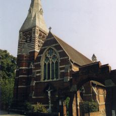
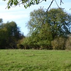
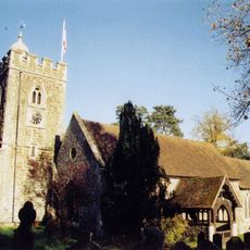
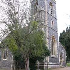
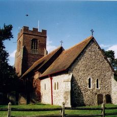
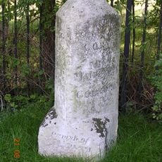
The residence reflects the English gentry's tradition of building grand country homes that served both practical and social purposes. Its placement next to St John the Baptist Church shows how such estates were often intertwined with local parish life.
The house remains a private residence and is not routinely open to the public. Visitors should check beforehand whether special access might be arranged or if the grounds can be viewed from nearby public areas.
The estate hosted the 1964 Great Steam Fair, one of the earliest gatherings of its kind in England. This event sparked wider interest in preserving steam locomotives and vintage vehicles across the country.
Location: Shottesbrooke
GPS coordinates: 51.48778,-0.79056
Latest update: December 12, 2025 09:02
Ockwells
3.8 km
Billingbear House
4.9 km
All Saints' Church, Maidenhead
5.2 km
Bray Meadows
5.5 km
Stubbings House
3.9 km
Church of All Saints, Binfield
5.1 km
Church of St. James the Less
4.5 km
Church of St Mary
1.4 km
Church of St Mary
5.4 km
Church of St Lawrence
1.1 km
Church of St John the Baptist, Shottesbrooke
150 m
Church of St James
4.4 km
Bell Inn
1.1 km
Lillibrooke Manor
3.2 km
Milestone Opposite Number 34
5.3 km
Milestone 220 Yards East Of Thicket Corner
4.1 km
Milestone At Ngr 7850 7605
5.7 km
Milestone, Henley Road; Speen Hill Golf Course
5.6 km
Milestone At Ngr 8488 8170
4.5 km
Hall Place
4.7 km
Milestone At Ngr 7960 7712
4.4 km
Binfield Park
5.6 km
Milestone At Ngr 8072 7805
3.5 km
Milestone Approximately 165 Metres West Of The Junction With Burchetts Lane
3.1 km
Mile Post About 80 Metres South West Of Burchetts Green School
3.9 km
Mile Post On A404 North North East Of Junction With A423
5.4 km
Milestone, Nearly Opposite Junction With Burchetts Green Road
3.1 km
Milestone At Ngr 8195 7902
2.8 kmVisited this place? Tap the stars to rate it and share your experience / photos with the community! Try now! You can cancel it anytime.
Discover hidden gems everywhere you go!
From secret cafés to breathtaking viewpoints, skip the crowded tourist spots and find places that match your style. Our app makes it easy with voice search, smart filtering, route optimization, and insider tips from travelers worldwide. Download now for the complete mobile experience.
A unique approach to discovering new places❞
— Le Figaro
All the places worth exploring❞
— France Info
A tailor-made excursion in just a few clicks❞
— 20 Minutes