Morwellham Quay, Living history museum in Tavistock, England
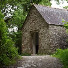
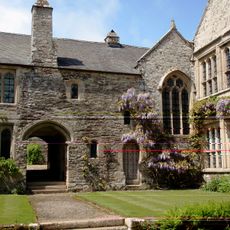
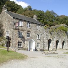
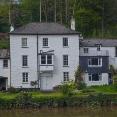
Morwellham Quay is an open-air museum in Tavistock featuring Victorian-era docks, restored buildings, and a copper mine accessible via narrow-gauge railway along the River Tamar. The site also includes a visitor center, historical workshops, and exhibition areas that document life and work from that period.
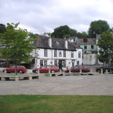
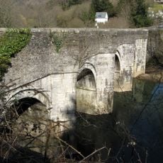
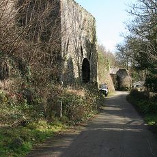
The site developed as a copper trading port and reached its peak during the Victorian era, becoming the primary copper port of the British Empire. It was later partially abandoned but gradually restored as a museum in the 20th century.
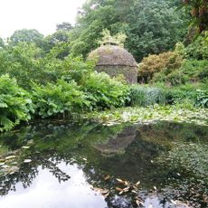
Visitors can watch traditional crafts being practiced and see how people lived daily in reconstructed cottages from the Victorian era. Costumed interpreters demonstrate historical trades and make the past directly tangible.
The museum grounds are laid out for longer exploration, with paths leading to various areas, some with slopes along the river. Comfortable shoes are recommended, and time should be reserved for the railway journey into the mine as well as for exploring individual buildings.
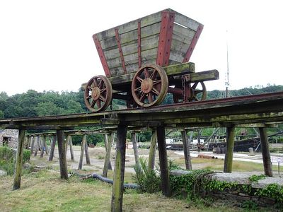
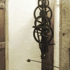
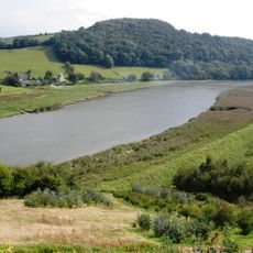
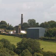
The site preserves a large overshot water wheel and an inclined plane rail system that once transported vessels between different water levels. These engineering solutions show the technical skill needed to make the challenging riversite practical for operations.
Location: Tavistock
Address: Morwellham, Tavistock PL19 8JL
Website: https://morwellham-quay.co.uk
GPS coordinates: 50.50530,-4.19361
Latest update: December 7, 2025 20:43
Cotehele clock
2.5 km
Church of St Andrew
949 m
The Prospect Tower
2.4 km
Cotehele
2.5 km
Chapel Of St George And St Thomas A Becket
2.3 km
Tamar Hotel
1.4 km
Cotehele House Chapel
2.5 km
Tamar Valley Mining District with Tavistock
2.1 km
Guide Post At Sx 459681
2 km
Cotehele Bridge
2.9 km
The Edgcumbe Arms With Attached Limekilns And Warehouse
2.6 km
Calstock Viaduct
1.5 km
New Bridge
2.9 km
Milestone At Sx 460 687
1.7 km
Dovecote About 80 Metres East Of Cotehele House
2.4 km
Water Tower
2 km
Milestone At Sx 450 712
1.7 km
Kelly House
1.5 km
Milestone At Sx 462 697
1.7 km
Lime Kiln
1.9 km
Milestone North East Of Kingswood House
2.3 km
Limekiln
1.7 km
The Old Toll House
2.9 km
Guidestone, Tavistock Cross, E of Bere Alston, at fork in road
2.6 km
Guidestone, fork where road leaves for Bere Ferrers & Calstock
2.7 km
Milestone, E of St Annes Chapel, by "Dunfree" bungalow
3 km
Guidestone, Tavistock Cross, E side of fork to Denhambridge
2.6 km
Guidestone, road to Calstock, at fork where road splits to Bere Ferrers and Alston
2.6 kmVisited this place? Tap the stars to rate it and share your experience / photos with the community! Try now! You can cancel it anytime.
Discover hidden gems everywhere you go!
From secret cafés to breathtaking viewpoints, skip the crowded tourist spots and find places that match your style. Our app makes it easy with voice search, smart filtering, route optimization, and insider tips from travelers worldwide. Download now for the complete mobile experience.
A unique approach to discovering new places❞
— Le Figaro
All the places worth exploring❞
— France Info
A tailor-made excursion in just a few clicks❞
— 20 Minutes