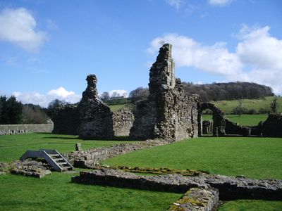
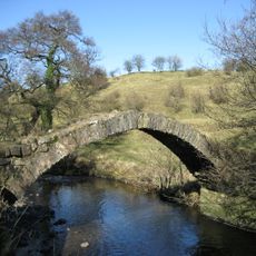
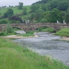
Sawley Abbey, 12th century Cistercian monastery ruins in Lancashire, England
Sawley Abbey is a 12th-century monastery in Lancashire whose remaining walls and foundations clearly outline the layout of the complex around a central courtyard. The visible sections include the church, dormitory, refectory, and kitchen areas, with stone-lined drainage systems still visible beneath the ground.
William de Percy II founded the monastery in 1146, and it thrived for nearly 400 years as an active religious community. The closure came in 1536 when Henry VIII's Dissolution of Monasteries brought an end to monastic life here.
The layout of the sleeping quarters, dining hall, and prayer spaces shows how monks organized their daily routines within these stone walls. Walking through these sections reveals the rhythm of monastic life that shaped this place for centuries.
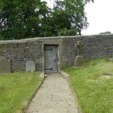
The site is open to visitors who can freely explore the stone structures and preserved foundations at their own pace. Information panels throughout the grounds help explain the different areas and how they were originally used.
The chancel section is notably wider than typical, while the nave remains unusually short compared to its proportions. This architectural imbalance reflects the financial constraints that shaped construction decisions throughout the project.
Location: Sawley
Inception: 12 century
Website: https://english-heritage.org.uk/visit/places/sawley-abbey
GPS coordinates: 53.91340,-2.33944
Latest update: December 10, 2025 20:06
Downham Hall
2.2 km
St Ambrose's Church, Grindleton
1.7 km
St Leonard's Church, Downham
2.2 km
Assheton Arms
2.2 km
Swanside Bridge
1.2 km
Sawley Bridge
368 m
Spread Eagle Hotel
222 m
Stocks
2.2 km
Friend's Meeting House and house adjoining to south west
598 m
Bolton Peel Cross
2.2 km
Sawley War Memorial, Lancashire
192 m
Post Office and house adjoining to east
2.2 km
Building on east side of yard at Home Farm, north west of Downham Hall
2.1 km
7 Top Row
2.2 km
Laneside Farmhouse
1.3 km
Door and surround in garden wall, Downham Hall, approximately 10 metres south west of church tower
2.2 km
Milestone at west side of road, near junction with Chatburn Road
2 km
Bank Hall
597 m
Downham Mill
1.8 km
2, 3 and 4 Top Row
2.2 km
Gazebo, 50 Metres South East Of Bank Hall
544 m
Milestone At Sd 78554653
756 m
Sundial In Churchyard Approximately 8 Metres South Of Chancel, Church Of St Leonard
2.2 km
Barn to Home Farm, north west of Downham Hall, and stable in same range to east
2.1 km
Sawley Grange Farmhouse and barn adjoining to east
1.5 km
Bolton Peel Farmhouse
2.2 km
5 and 6 Top Row
2.2 km
Pair of gatepiers in Downham Hall garden, approximately 60 metres north west of school
2.3 kmVisited this place? Tap the stars to rate it and share your experience / photos with the community! Try now! You can cancel it anytime.
Discover hidden gems everywhere you go!
From secret cafés to breathtaking viewpoints, skip the crowded tourist spots and find places that match your style. Our app makes it easy with voice search, smart filtering, route optimization, and insider tips from travelers worldwide. Download now for the complete mobile experience.
A unique approach to discovering new places❞
— Le Figaro
All the places worth exploring❞
— France Info
A tailor-made excursion in just a few clicks❞
— 20 Minutes