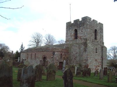
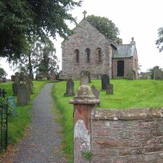
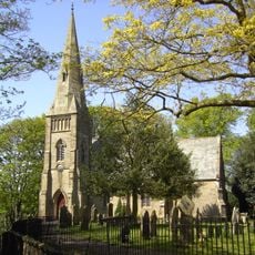
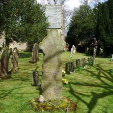
St Michael's Church, Burgh by Sands, Norman church in Burgh by Sands, England
St Michael's Church is a stone church in Burgh by Sands featuring two distinct towers, with the western tower rising three stories and displaying defensive features such as arrow slits and thick walls. The building combines Norman and Gothic architectural elements reflecting different periods of its development.
The church was built in the 12th century using stones from Hadrian's Wall and the Roman fort of Aballava, demonstrating the reuse of ancient materials in medieval construction. It was reinforced and modified during periods of border conflict to serve defensive purposes.
The church serves as a spiritual center for the village and draws walkers exploring the historic border region. Its presence anchors the community's connection to centuries of local life and heritage.
The church is accessible to visitors year-round and sits along the Hadrian's Wall walking path, making it a natural stopping point for walkers. Wear comfortable shoes as the terrain around the church is uneven and paths lead toward the river.
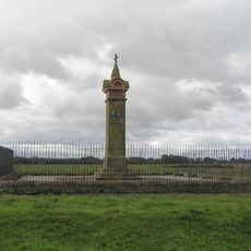
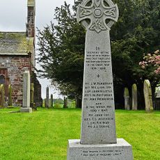
King Edward I lay in state here for 10 days in 1307 before his final burial. This brief but significant royal moment elevated this modest church to a place of national historical importance.
Location: Burgh by Sands
Inception: 12 century
Architectural style: English Gothic architecture, Norman architecture
Website: http://achurchnearyou.com/burgh-by-sands-st-michael
GPS coordinates: 54.92210,-3.04890
Latest update: December 13, 2025 12:23
Lochmaben Stone
7 km
Coggabata
6.4 km
Drumburgh Castle
6.3 km
St Peter's Church, Kirkbampton
3.5 km
Milecastle 75
4.8 km
Church of St Barnabas
6.2 km
Church of St Giles
4.8 km
Church of St Mary
1.9 km
Church of St Kentigern
4.5 km
Church of St Mary
3.9 km
Park Farm Cottage And Adjoining Barn
4.2 km
The Greyhound Inn
494 m
Cumberland Infirmary
6.7 km
King Edward I Monument
1.8 km
Dykesfield Bridge
2.1 km
Coledale Hall
6.3 km
Kirkbampton War Memorial
3.5 km
Waverley Viaduct
6 km
Cross Farm And Adjoining Barns
145 m
Milestone At National Grid Reference Ny 39610 61400
7 km
Milestone Outside Suttle House
6.9 km
Milestone East Of Number 325
6.6 km
Churchyard Cross, South Of Church Of St Mary
3.9 km
Park Farmhouse
4.2 km
Burgh Head House
88 m
Buck Bottom And Adjoining Barn
192 m
Lamonby Farmhouse And Adjoining Barn
177 m
Milestone, newly constructed road for non-motorway traffic, back of Shell petrol station; M74 carriageway
5.4 kmVisited this place? Tap the stars to rate it and share your experience / photos with the community! Try now! You can cancel it anytime.
Discover hidden gems everywhere you go!
From secret cafés to breathtaking viewpoints, skip the crowded tourist spots and find places that match your style. Our app makes it easy with voice search, smart filtering, route optimization, and insider tips from travelers worldwide. Download now for the complete mobile experience.
A unique approach to discovering new places❞
— Le Figaro
All the places worth exploring❞
— France Info
A tailor-made excursion in just a few clicks❞
— 20 Minutes