St Nicholas' Church, Islip

Log in to your account

AroundUs is a community-driven map of interesting places, built by curious explorers like you. It grows with every review, story, and photo you share.
Connect to save your favorite spots, contribute locations, and create personalized routes.
Continue with Google
Continue with Apple
Continue with X
Continue with Facebook
Continue with email
By continuing, you accept our Terms and Conditions and our Privacy Policy
Create an account

St Nicholas' Church, Islip

Add to collection
Map
Suggest a change
Share

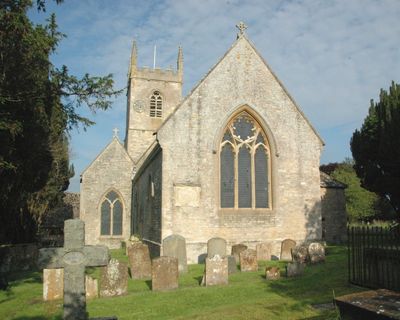
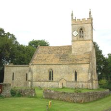
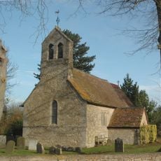
St Nicholas' Church, Islip, Medieval church in Islip, England.

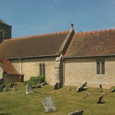
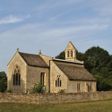
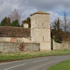
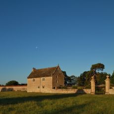
St Nicholas' Church is a limestone building with Gothic features consisting of a nave, chancel, north-east vestry, south porch, and west tower. The structure displays intricate stonework and large windows that fill the interior with light and create an open feeling throughout the space.

The church originated around 1050 but underwent significant changes in 1780 when the chancel was reconstructed and again in 1861 during renovations by architect E.G. Bruton. These modifications shaped its present appearance and reflect the architectural preferences of different eras.

The church displays medieval wall paintings from the 14th century showing religious scenes such as the Adoration of the Magi and a weighing of souls that visitors can observe during their visit. These artworks remained hidden beneath plaster for centuries and offer insight into the spiritual beliefs of the medieval period.

The church is typically accessible daily as it remains an active place of worship and prayer. Visitors should wear appropriate clothing and speak quietly to respect the quietness of the space.

Local tradition holds that Edward the Confessor, who granted the church to Westminster Abbey in 1065, was baptized in an earlier church at this location. This connection to a saint-king adds an extra layer of historical significance to the place.

Location: Islip

Inception: 11 century

Architectural style: English Gothic architecture

GPS coordinates: 51.82290,-1.23778

Latest update: December 14, 2025 16:46

Photos
Around this place
Church of the Holy Rood, Woodeaton
United Kingdom

Church of the Holy Rood, Woodeaton

2.3 km
Chapel At Water Eaton Manor House
United Kingdom

Chapel At Water Eaton Manor House

2.2 km
Church of St Mary
United Kingdom

Church of St Mary

3 km
Church of St Giles
United Kingdom

Church of St Giles

2 km
Church of St Andrew
United Kingdom

Church of St Andrew

2.7 km
Church of St Mary
United Kingdom

Church of St Mary

3.1 km
74 and 76, Church Street
United Kingdom

74 and 76, Church Street

3 km
86 and 88, Church Street
United Kingdom

86 and 88, Church Street

3 km
78, Church Street
United Kingdom

78, Church Street

3 km
82 and 84, Church Street
United Kingdom

82 and 84, Church Street

3 km
Kings Arms Public House And Attached Mounting Block
United Kingdom

Kings Arms Public House And Attached Mounting Block

2.4 km
Kidlington and Hamlets War Memorial
United Kingdom

Kidlington and Hamlets War Memorial

3 km
Islip (Oxfordshire) War Memorial
United Kingdom

Islip (Oxfordshire) War Memorial

133 m
Manor House
United Kingdom

Manor House

2.3 km
Old Priest's House
United Kingdom

Old Priest's House

3 km
Northfield Farmhouse
United Kingdom

Northfield Farmhouse

1.3 km
Woodeaton Cross
United Kingdom

Woodeaton Cross

2.3 km
Gateway Approximately 30 Metres East Of Water Eaton Manor House
United Kingdom

Gateway Approximately 30 Metres East Of Water Eaton Manor House

2.3 km
The Old Manor House
United Kingdom

The Old Manor House

2.9 km
Manor House, Water Tower, Workshops And Attached Walls Approximately 70 Metres To South East
United Kingdom

Manor House, Water Tower, Workshops And Attached Walls Approximately 70 Metres To South East

2.3 km
Morton Almshouses
United Kingdom

Morton Almshouses

2.9 km
South Pavilion And Attached Walls Approximately 40 Metres East Of The Manorhouse
United Kingdom

South Pavilion And Attached Walls Approximately 40 Metres East Of The Manorhouse

2.3 km
Model Farmhouse
United Kingdom

Model Farmhouse

2.8 km
Chest tomb approximately 1/2 metre west of Church of St Mary
United Kingdom

Chest tomb approximately 1/2 metre west of Church of St Mary

3 km
Dovecote Approximately 80 Metres East Of The Manorhouse
United Kingdom

Dovecote Approximately 80 Metres East Of The Manorhouse

2.2 km
Poyle Court
United Kingdom

Poyle Court

2.9 km
North Pavilion And Attached Walls Approximately 40 Metres North East Of The Manorhouse
United Kingdom

North Pavilion And Attached Walls Approximately 40 Metres North East Of The Manorhouse

2.2 km
Manor House
United Kingdom

Manor House

2.2 km
Show the full map
Reviews

Visited this place? Tap the stars to rate it and share your experience / photos with the community! Try now! You can cancel it anytime.

« St Nicholas' Church, Islip - Medieval church in Islip, England » is provided by Around Us (aroundus.com). Images and texts are derived from Wikimedia project under a Creative Commons license. You are allowed to copy, distribute, and modify copies of this page, under the conditions set by the license, as long as this note is clearly visible.

Discover hidden gems everywhere you go!

From secret cafés to breathtaking viewpoints, skip the crowded tourist spots and find places that match your style. Our app makes it easy with voice search, smart filtering, route optimization, and insider tips from travelers worldwide. Download now for the complete mobile experience.

Around Us App Screenshot

A unique approach to discovering new places

Le Figaro

All the places worth exploring

France Info

A tailor-made excursion in just a few clicks

20 Minutes