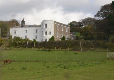
Stowford House, English country house in Harford, Great Britain.
Stowford House is a country residence built from stone with an H-shaped plan, featuring slate roofs and multiple external chimney stacks throughout its structure. The windows display carved stone mullions characteristic of its original period design.
The house was built in the 16th century and underwent significant renovations during the 18th century when major changes were made to its structure. It received official protection status in 1952 as a Grade II listed building.
The house carries the memory of prominent figures born here who went on to hold significant positions in national life. This connection gives the building a deeper meaning beyond its role as a residence.
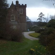
The building has been divided into three separate residential units, reflecting its current private status as a home. Visitors should be aware this is private property and can only be viewed from outside.
The upper floor contains a room with 18th-century wooden paneling that preserves a notable stone fireplace from the 16th century within its walls. This layering of periods reveals how the house combines different eras within a single space.
Location: Harford
GPS coordinates: 50.39690,-3.91361
Latest update: December 14, 2025 17:04
Church of St Petroc
2.5 km
Curzon Cinema at the Watermark
917 m
Lower Keaton Bridge
2.5 km
Ivybridge Viaduct including adjacent piers of earlier viaduct
458 m
The Bridge
781 m
Methodist Church Including Boundary Wall To North And West
1.2 km
Harford Bridge
2.6 km
Bittaford Viaduct
2.5 km
Cross In Church Yard Approximately 50 Metres South South West Of Church Of St Petroc
2.5 km
Penquit Manor House
2.9 km
Unenclosed stone hut circle settlement west of Butter Brook Reservoir
2.4 km
Stowford Paper Mills
621 m
Cairn near the summit of Western Beacon
1.6 km
Chambered cairn in Cuckoo Ball newtake
2.2 km
Hall Farm House
2.9 km
Cist east of Hangershell Rock
2.9 km
Milestone Immediately North East Of Torr Hill (House)
662 m
Barn Approximately 10 Metres West Of Penquit Manor House
2.9 km
Ludbrook Mill And House
3.2 km
One of a group of four cairns on Butterdon Hill
2.2 km
Lukesland
994 m
Caton House
2.4 km
Two cairns on the south side of Ugborough Beacon
3.2 km
Cairn to the east of Hangershell Rock
2.9 km
Guidestone, Cross In Hand, Exeter Road, turn to Rugby Club
1 km
Cairn to the west of Tristis Rock, Burford Down
3.2 km
Milestone, Ugborough Road, Bittaford & Little Bittaford just down from Meadows View
2.9 km
Milepost, Bittaford, E end of village by car sales
2.8 kmVisited this place? Tap the stars to rate it and share your experience / photos with the community! Try now! You can cancel it anytime.
Discover hidden gems everywhere you go!
From secret cafés to breathtaking viewpoints, skip the crowded tourist spots and find places that match your style. Our app makes it easy with voice search, smart filtering, route optimization, and insider tips from travelers worldwide. Download now for the complete mobile experience.
A unique approach to discovering new places❞
— Le Figaro
All the places worth exploring❞
— France Info
A tailor-made excursion in just a few clicks❞
— 20 Minutes