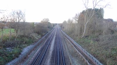
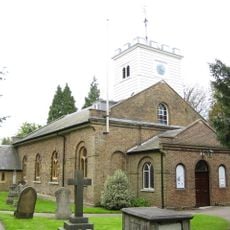
Northern Line Embankment, High Barnet, Nature reserve along Northern Line in High Barnet, England.
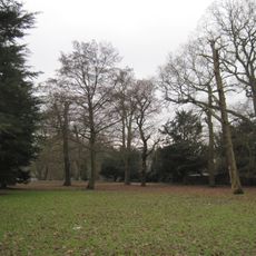
The Northern Line Embankment is a nature reserve stretching between Totteridge and High Barnet stations, consisting of low vegetation, brambles, and secondary woodland. Silver birch and sycamore trees dominate the slope and give the reserve its character.
The embankment was created during Northern Line construction in 1940, when London Underground extended services to High Barnet. This expansion was part of the Northern Heights project, which connected northwestern districts to the city center.
The embankment shows how London's railway development created habitats where nature could flourish alongside infrastructure. The vegetation grows undisturbed along the line and serves as a refuge for wildlife in this urban area.
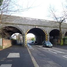
You can view the reserve from the road bridge connecting Whetstone High Road to the Brook Farm Open Space car park or from the footbridge at Walfield Avenue. Remember that direct access is limited, so these bridges offer the best viewing points.
The embankment is home to one of the few common lizard colonies in Barnet, protected by limited access and the absence of pesticides. These reptiles find the crevices and dry spots on the slope ideal for shelter and breeding.
Location: London Borough of Barnet
GPS coordinates: 51.64000,-0.18400
Latest update: December 14, 2025 16:46
Barnet House, London
1.3 km
Odeon Cinema, Barnet
759 m
New Barnet War Memorial
1.2 km
St Andrew's Church
1.4 km
Holy Trinity Lyonsdown
1 km
Greenhill Gardens
524 m
St Mark's Church
1.5 km
St Mary Magdalen Catholic Church, Whetstone
1.2 km
Barnet Synagogue
772 m
Christ Church at Whetstone
1.4 km
Mary Immaculate and St Peter, New Barnet
1.1 km
East Barnet Town Hall
1.3 km
St John's United Reformed Church
987 m
New Barnet Congregational Church
1.1 km
New Barnet Methodist Chapel
1.2 km
New Barnet Friends Meeting House
1.2 km
The Whetstone Outside The Griffin Public House Number 1262
1.3 km
1264, High Road N20
1.3 km
Southernhay
1.4 km
Totteridge War Memorial
1.4 km
1270, High Road N20
1.3 km
Barn To North West Of Church Of St Andrew
1.4 km
The Old House
1.3 km
The Vicarage
1.3 km
The Limes
1 km
Milestone, Great North Road, Pricklers Hill, just S of Raydean Road, near Raydean House
586 m
1266 And 1268, High Road N20
1.3 km
Longmore Avenue railway bridge
1 kmVisited this place? Tap the stars to rate it and share your experience / photos with the community! Try now! You can cancel it anytime.
Discover hidden gems everywhere you go!
From secret cafés to breathtaking viewpoints, skip the crowded tourist spots and find places that match your style. Our app makes it easy with voice search, smart filtering, route optimization, and insider tips from travelers worldwide. Download now for the complete mobile experience.
A unique approach to discovering new places❞
— Le Figaro
All the places worth exploring❞
— France Info
A tailor-made excursion in just a few clicks❞
— 20 Minutes