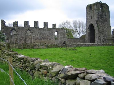
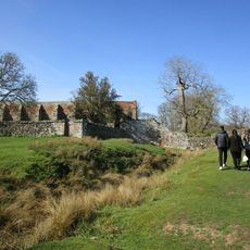
Ulverscroft Priory, Medieval priory ruins in Leicestershire, England.
Ulverscroft Priory is a medieval monastery ruin featuring a three-stage western tower with granite walls and sections of red brick details. The layout still shows parts of the nave and chancel, where medieval tiles and carved stone elements survive among the remains.
The priory was founded in 1134 by Robert, Earl of Leicester, and operated as an Augustinian community for about 400 years until its closure in 1539. This long span of religious life reflects the importance of monastic houses in medieval England.
The complex reflects how medieval religious communities hosted travelers and worshippers through dedicated structures like a guesthouse. The physical layout shows the organized rhythm of monastic life and hospitality that shaped the surrounding area.
The site remains private property with limited public access, so visitors can view it mainly from outside. The ruins sit in an open setting that is passable year-round, though weather conditions may vary.
The 14th-century chancel windows preserve carved stone patterns including quatrefoils and tracery, showing rare examples of medieval craftsmanship still visible today. These delicate details survive despite the windows being partially blocked, offering a glimpse into the artistic skill of the original builders.
The community of curious travelers
AroundUs brings together thousands of curated places, local tips, and hidden gems, enriched daily by 60,000 contributors worldwide.