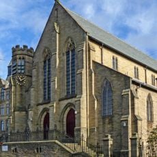
Undercliffe Cemetery, Grade II* listed cemetery in Bolton and Undercliffe, England
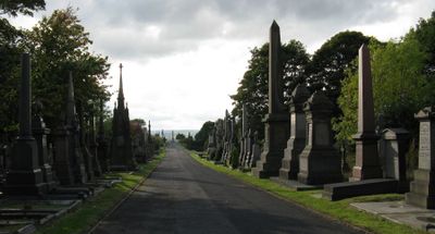
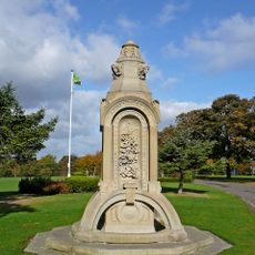
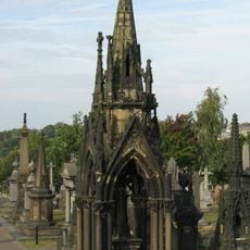
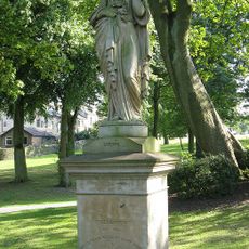
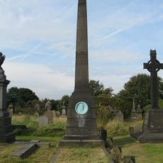
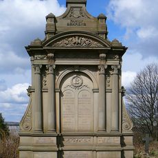
Undercliffe Cemetery is a Grade II* listed burial ground spread across 26 acres on a hillside, containing over 120,000 burials with many Victorian-era monuments that overlook Bradford. The grounds feature marked graves and structured paths throughout, displaying a cemetery plan that has remained largely unchanged since its creation.
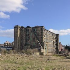
William Gay designed the cemetery between 1851 and 1854 on former agricultural land from the Undercliffe Estate in response to Bradford's rapid textile industry expansion. Its creation became necessary because existing burial grounds could not accommodate the city's fast-growing population.
The grounds are divided into sections for Anglican burials on the western side and non-conformist groups like Baptists, Methodists, and Quakers on the eastern side, reflecting the community's religious diversity. Walking through these areas shows how different faiths were accommodated in the same space.
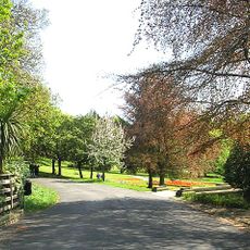
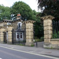
The site is managed by the Undercliffe Cemetery Charity with support from local volunteers who maintain the paths and preserve the monuments year-round. Visitors should wear sturdy footwear since the terrain is hilly and can become slippery in wet conditions.
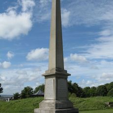
A main east-west promenade traverses the grounds and connects major monuments including the Joseph Smith Obelisk and the Mawson Monument. This central pathway offers visitors views of Bradford as they walk and provides a natural way to explore the cemetery's layout.
Location: Bolton and Undercliffe
Inception: 1851
Website: https://undercliffecemetery.co.uk
GPS coordinates: 53.80400,-1.73700
Latest update: December 10, 2025 20:05
Peel Park, Bradford
646 m
Al-Mahdi Mosque
586 m
Beaumont Memorial Fountain To North Of Cliffe Road Lodge
446 m
Church of St James
980 m
Church of St Clement
763 m
Statue of Sir Robert Peel in Exhedra on South Heights
650 m
Swithun Anderton Monument
24 m
Miles Moulson Monument
129 m
Statues Of Autumn And Spring On Drive, One Approximately 21 Yards To East And One Approximately 96 Yards To West Of Statue Of Sir Robert Peel
666 m
Mawson Monument
86 m
Barkerend Mills
885 m
Drinking Fountain On East Drive South Of Lister Lane
674 m
Bolton Road Lodge, Gate Piers And Gates To Peel Park
911 m
Carlton-Bolling School
729 m
Cliffe Road Lodge, Gate Piers And Gates To Peel Park
446 m
Bradford College, Cathedral Building
943 m
Joseph Smith Obelisk
213 m
Illingworth Mausoleum
26 m
Byron First School
659 m
Wapping Road School With Attached Steps And Boundary Walls
717 m
Former Doorway Re-Erected On South Side Of Lower Lake, With The Adjoining Section Of Wall
762 m
Behrens Mausoleum
27 m
Former Craft Block At Carlton-Bolling School
709 m
Barkerend School And Attached Shed And Boundary Wall
729 m
Guy's Cliffe
256 m
Butler House
802 m
Boldshay Hall
620 m
Milestone, Otley Road; nr Peel Park, opp. Cliffe Road
358 mVisited this place? Tap the stars to rate it and share your experience / photos with the community! Try now! You can cancel it anytime.
Discover hidden gems everywhere you go!
From secret cafés to breathtaking viewpoints, skip the crowded tourist spots and find places that match your style. Our app makes it easy with voice search, smart filtering, route optimization, and insider tips from travelers worldwide. Download now for the complete mobile experience.
A unique approach to discovering new places❞
— Le Figaro
All the places worth exploring❞
— France Info
A tailor-made excursion in just a few clicks❞
— 20 Minutes