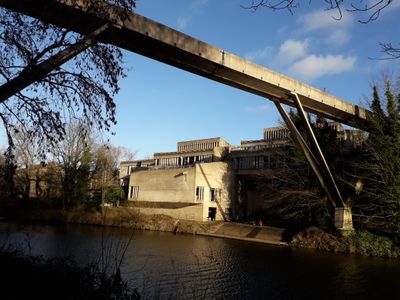
Kingsgate Bridge, Grade I listed footbridge in Durham, England
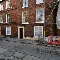
Kingsgate Bridge is a concrete pedestrian crossing that spans the River Wear and connects two areas of Durham University. The two sections meet at a central bronze expansion joint, running between Bow Lane and Dunelm House.
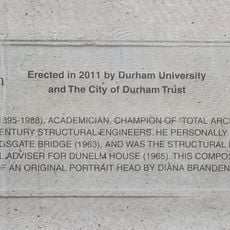
Engineer Ove Arup designed this bridge in 1963 near the end of his career. The structure received the Civic Trust Award in 1965 for its innovative approach to river crossing design.
The bridge's name references a historic city gate, and it serves as a daily crossing for students moving between university grounds and the town below. Its bronze memorial to the designer has become part of how people remember this place.
The bridge is open daily to pedestrians and provides a direct route between university grounds and the town center. The surface is solid and flat, making it easy for anyone to cross in most weather conditions.
The bridge was built using an unusual method where two halves were constructed parallel to the riverbanks and then rotated 90 degrees to meet in the middle. This eliminated the need for traditional scaffolding across the river.
Location: City of Durham
Inception: 1967
Official opening: 1966
GPS coordinates: 54.77306,-1.57250
Latest update: December 8, 2025 20:02
Dunelm House
52 m
Church of St Oswald
185 m
Durham Heritage Centre and Museum
142 m
Langford House
154 m
Ramsey House
175 m
Commemorative plaque to Ove Arup
42 m
St Chad's College: 18 (South), North Bailey
144 m
Chapter Clerk's Office And Chapter Room
198 m
Durham War Memorial
178 m
St Chad's College: 18 (North), North Bailey
145 m
St Chad's College: 16 North Bailey
146 m
28, North Bailey
190 m
St Chad's College: 17 North Bailey
144 m
Hatfield College Office Building
106 m
St Chad's College: 20 North Bailey
151 m
Union Society
169 m
Wall on South Side of Steps Leading from Lane to River
57 m
House North Of St.Mary-Le-Bow
158 m
Kingsgate
115 m
House To South Of No. 28
199 m
26, North Bailey
180 m
St Chad's College: 19 (North), North Bailey
148 m
Wall With Entrance Arch And Mounting Block, Opposite To Nos. 19-22A Consecutive
168 m
27, North Bailey
186 m
Terrace Wall South Of Bow Lane And East Of Kinsgate
76 m
23, North Bailey
163 m
Castle Wall Behind Nos. 16-22 And No.22a (st. Chad's)
111 m
Castle Walls Terrace Wall North Of Bow Lane
80 mVisited this place? Tap the stars to rate it and share your experience / photos with the community! Try now! You can cancel it anytime.
Discover hidden gems everywhere you go!
From secret cafés to breathtaking viewpoints, skip the crowded tourist spots and find places that match your style. Our app makes it easy with voice search, smart filtering, route optimization, and insider tips from travelers worldwide. Download now for the complete mobile experience.
A unique approach to discovering new places❞
— Le Figaro
All the places worth exploring❞
— France Info
A tailor-made excursion in just a few clicks❞
— 20 Minutes