Enable Location

We need your location to show you interesting places around you

Discover nearby places

Find interesting locations and hidden gems around you

Precise directions

Get accurate directions and distances to places

Your location is never shared with other users. It's only used when you tap the location button.

Caer Drewyn

Log in to your account

Start exploring — it's free

Trusted by 62,846 travelers worldwide

Continue with Google
Continue with Apple
or

We will send you a code to connect

By continuing, you accept our Terms and Conditions and our Privacy Policy

Check your inbox

We've sent a pincode in your inbox. Please enter the code below.

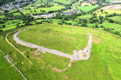
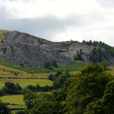
Caer Drewyn, Iron Age hillfort in Denbighshire, Wales

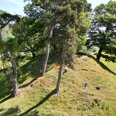
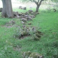
Caer Drewyn is an Iron Age fort on a hillslope in Denbighshire that spans several hectares with substantial stone walls and two entrances positioned on the west and northeast sides. The structure shows archaeological evidence of multiple building phases, with traces of guard chambers and sophisticated defensive systems.

The first fortification began as a small earthwork, but evolved into a larger structure with massive stone walls around 500 BCE. During the medieval period, Welsh leaders reused this strategic location to gather and coordinate military forces against external threats.

The site carries memories of medieval times, when Welsh leaders used the height to protect and control their territories. Visitors can sense through these historical connections how important this place was to local people and their independence.

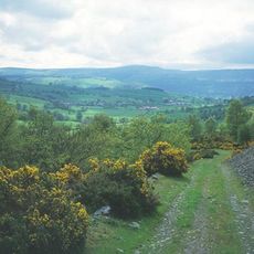
The site is accessible on foot by parking at the leisure center along B5437 and following a marked trail that takes about twenty minutes to walk. Sturdy footwear and good fitness help as the path goes uphill and can be slippery when wet.

Unlike many Iron Age forts built with earthen banks, this location used abundant local stone for its walls and constructed specialized guard chambers. This shows advanced building techniques and strategic understanding of defensive needs in the region.

The community of curious travelers

AroundUs brings together thousands of curated places, local tips, and hidden gems, enriched daily by 60,000 contributors worldwide.

Start exploring
Location
GPS coordinates
52.98920,-3.36010
Latest update
December 14, 2025 14:42
« Caer Drewyn - Iron Age hillfort in Denbighshire, Wales » is provided by Around Us (aroundus.com). Images and texts are derived from Wikimedia project under a Creative Commons license. You are allowed to copy, distribute, and modify copies of this page, under the conditions set by the license, as long as this note is clearly visible.

Discover hidden gems everywhere you go!

From secret cafés to breathtaking viewpoints, skip the crowded tourist spots and find places that match your style. Our app makes it easy with voice search, smart filtering, route optimization, and insider tips from travelers worldwide. Download now for the complete mobile experience.

Around Us App Screenshot

A unique approach to discovering new places

Le Figaro

All the places worth exploring

France Info

A tailor-made excursion in just a few clicks

20 Minutes

Around Us
Travel Guide & Maps
Download

Send to your phone

QR Code
1

Open the camera app on your mobile.

2

Point at the QR code with your camera. A notification will appear.

3

Tap the notification to open the link.