The Rumps

Log in to your account

AroundUs is a community-driven map of interesting places, built by curious explorers like you. It grows with every review, story, and photo you share.
Connect to save your favorite spots, contribute locations, and create personalized routes.
By continuing, you accept our Terms and Conditions and our Privacy Policy
Add to collection
Map
Suggest a change
Share

The Rumps, Iron Age promontory fort in Cornwall, England
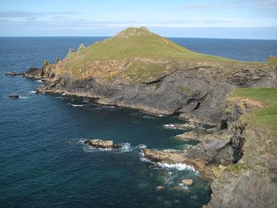
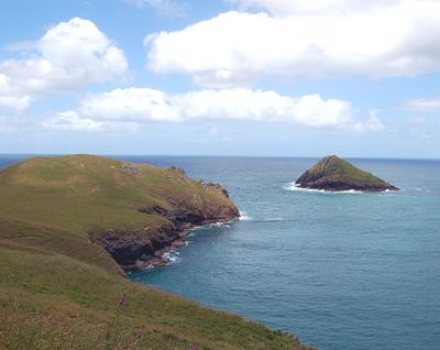
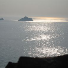
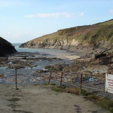
The Rumps is a fortified settlement on a coastal promontory in Cornwall with three defensive banks featuring rock-cut ditches on its southern side. Natural sea cliffs form the remaining edges of this installation.

The site dates to the Iron Age and was occupied between roughly 200 and 50 BCE, with archaeological digs revealing three distinct construction phases. The layered finds show two separate occupation periods, marked by changes in building methods.

The site contains residential platforms where archaeologists found everyday objects such as spindle whorls and quern stones. These discoveries show that residents maintained trade connections with distant regions.
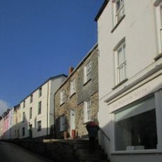
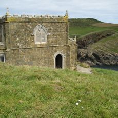
Access requires sturdy footwear to navigate safely across uneven ground and reduce slip hazards. Visitors should be prepared for changing weather conditions due to the exposed coastal location.

This coastal installation belongs to fewer than 100 known examples of its type in Britain and offers rare insights into Iron Age defensive techniques. The combination of man-made banks and natural cliffs creates an unusual architectural system.

Location: St Minver Highlands

Website: https://nationaltrust.org.uk/holidays/rumps-cornwall

GPS coordinates: 50.59279,-4.92038

Latest update: December 9, 2025 18:47

Photos
Around this place
Show the full map
St Enodoc's Church, Trebetherick
United Kingdom

St Enodoc's Church, Trebetherick

3.9 km
Polzeath Beach
United Kingdom

Polzeath Beach

2.1 km
Church of St Menefreda
United Kingdom

Church of St Menefreda

5 km
Church of St Michael
United Kingdom

Church of St Michael

5.7 km
The Shipwrights
United Kingdom

The Shipwrights

5.7 km
Abbey House
United Kingdom

Abbey House

5.8 km
Hillside
United Kingdom

Hillside

5.8 km
Padstow War Memorial
United Kingdom

Padstow War Memorial

5.2 km
Doyden Castle
United Kingdom

Doyden Castle

3.4 km
The Mouls
United Kingdom

The Mouls

563 m
Tregirls Cottages
United Kingdom

Tregirls Cottages

5.2 km
Porthilly Greys
United Kingdom

Porthilly Greys

5.7 km
The Long Cross, an early Christian memorial stone and medieval wayside cross, and a post-medieval guide post 400m north of Treli
United Kingdom

The Long Cross, an early Christian memorial stone and medieval wayside cross, and a post-medieval guide post 400m north of Treli

5.7 km
North Quay Walls
United Kingdom

North Quay Walls

5.7 km
Lellissick Farmhouse
United Kingdom

Lellissick Farmhouse

4.5 km
Entrance Gate And Flanking Walls Forming Mock Fortifications To East Of Prideaux Place
United Kingdom

Entrance Gate And Flanking Walls Forming Mock Fortifications To East Of Prideaux Place

5.8 km
Dairy and Grotto
United Kingdom

Dairy and Grotto

5.8 km
Footbridge Over Road To North East Of Prideaux Place
United Kingdom

Footbridge Over Road To North East Of Prideaux Place

5.8 km
12 And 14, Cross Street
United Kingdom

12 And 14, Cross Street

5.8 km
The Daymark
United Kingdom

The Daymark

3.6 km
The Stables
United Kingdom

The Stables

5.8 km
Slip And Retaining Wall On South And East Side Of Beach
United Kingdom

Slip And Retaining Wall On South And East Side Of Beach

3.7 km
Polyphant House  Railings To Front
United Kingdom

Polyphant House Railings To Front

5.9 km
Footbridge Over Lane To Estate Yard And Flanking Walls Forming North End Of Mock Fortifications To North East Of Prideaux Place
United Kingdom

Footbridge Over Lane To Estate Yard And Flanking Walls Forming North End Of Mock Fortifications To North East Of Prideaux Place

5.8 km
Roscarrock
United Kingdom

Roscarrock

5.3 km
Pentire Head, Poem For the Fallen Memorial
United Kingdom

Pentire Head, Poem For the Fallen Memorial

1 km
Guidestone, Trelights, Longcross crossroads, opp Long Cross Hotel
United Kingdom

Guidestone, Trelights, Longcross crossroads, opp Long Cross Hotel

5.7 km
HMS Warwick Memorial, Padstow
United Kingdom

HMS Warwick Memorial, Padstow

5.7 km
Show the full map
Reviews

Visited this place? Tap the stars to rate it and share your experience / photos with the community! Try now! You can cancel it anytime.

« The Rumps - Iron Age promontory fort in Cornwall, England » is provided by Around Us (aroundus.com). Images and texts are derived from Wikimedia project under a Creative Commons license. You are allowed to copy, distribute, and modify copies of this page, under the conditions set by the license, as long as this note is clearly visible.

Discover hidden gems everywhere you go!

From secret cafés to breathtaking viewpoints, skip the crowded tourist spots and find places that match your style. Our app makes it easy with voice search, smart filtering, route optimization, and insider tips from travelers worldwide. Download now for the complete mobile experience.

Around Us App Screenshot

A unique approach to discovering new places

Le Figaro

All the places worth exploring

France Info

A tailor-made excursion in just a few clicks

20 Minutes