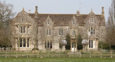
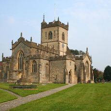
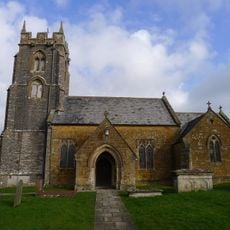
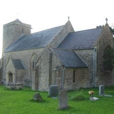
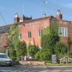
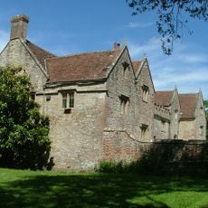
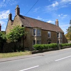
The Abbey, Ditcheat, Medieval country house in Ditcheat, England.
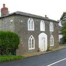
The Abbey is a country house in Ditcheat with a two-storey L-shaped form, its frontage marked by four prominent gables and multiple chimneys rising from stone-tiled roofs. The building features stone construction with ashlar dressings and combines preserved medieval elements like coffered ceilings with additions from later periods.
The building was founded in 1473 by John Gunthorpe, Dean of Wells, and underwent major changes in 1667 under Christopher Coward. Victorian modifications in the 1860s added architectural details that define its appearance today.
The building demonstrates the architectural evolution from religious rectory to residential dwelling, incorporating both medieval and Victorian Gothic design elements throughout its structure.
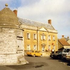
The property is a Grade II* listed structure with protected status, and can be viewed from the public spaces surrounding it. Visitors should be aware this is private land with limited access to the interior.
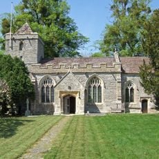
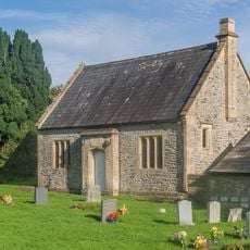
The grounds include an 18th-century granary with timber framing and brick filling, topped by a distinctive pyramid roof covered in stone tiles. This separate building reflects the varied structures that once served the estate.
Location: Ditcheat
GPS coordinates: 51.12330,-2.53917
Latest update: December 14, 2025 17:41
Church of All Saints, East Pennard
3 km
Royal Bath and West Show
3.8 km
Church of St Peter
3.6 km
Church of St Peter
3.7 km
Church of St Mary Magdalene, Ditcheat
280 m
Church of All Saints, Alford
4 km
Church of St Thomas à Becket
2.7 km
Alhampton Mission Church
1.6 km
Church of St Andrew
3.6 km
Church of St Mary and St John
3.8 km
Former Schoolroom, In The Churchyard, South Of Church Of St Mary Magdalene
247 m
Ditcheat War Memorial
239 m
Manor House Inn
203 m
The Post Office, And Front Boundary Wall
4.1 km
Ditcheat Manor
313 m
Ansford War Memorial
3.5 km
Pylle Manor And Attached Walled Garden At Rear
2.7 km
Castle Cary Library
4.1 km
Milepost On Roadside At Ngr St 6395 3637
1.6 km
Milestone At Ngr St 6324 3341
2.9 km
Milepost On Roadside At Ngr St 6394 3796
2.4 km
Village cross to west of Church of St Peter
3.6 km
Bolter's Bridge
3.2 km
Milepost On Roadside At Ngr St 6516 3865
3.8 km
Butwell Gate Toll House
2.6 km
Ansford Lodge
3.7 km
Milepost, Street on the Fosse, nr Bridge Farm
3.4 km
Milestone, Ansford Hill, jct with Lower Ansford
3.2 kmVisited this place? Tap the stars to rate it and share your experience / photos with the community! Try now! You can cancel it anytime.
Discover hidden gems everywhere you go!
From secret cafés to breathtaking viewpoints, skip the crowded tourist spots and find places that match your style. Our app makes it easy with voice search, smart filtering, route optimization, and insider tips from travelers worldwide. Download now for the complete mobile experience.
A unique approach to discovering new places❞
— Le Figaro
All the places worth exploring❞
— France Info
A tailor-made excursion in just a few clicks❞
— 20 Minutes