Enable Location

We need your location to show you interesting places around you

Discover nearby places

Find interesting locations and hidden gems around you

Precise directions

Get accurate directions and distances to places

Your location is never shared with other users. It's only used when you tap the location button.

Ilam Park

Log in to your account

Start exploring — it's free

Trusted by 63,618 travelers worldwide

Continue with Google
Continue with Apple
or

We will send you a code to connect

By continuing, you accept our Terms and Conditions and our Privacy Policy

Check your inbox

We've sent a pincode in your inbox. Please enter the code below.

Ilam Park
Discussion Reviews 1 Photos
8.3k Popularity

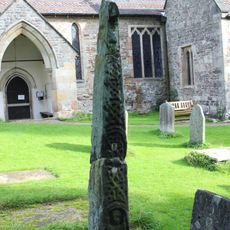
Ilam Park, Country estate and parkland in Ilam, England.

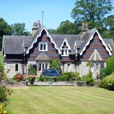
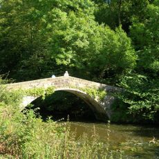
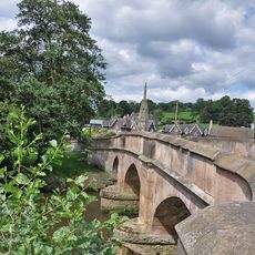
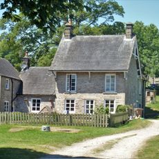
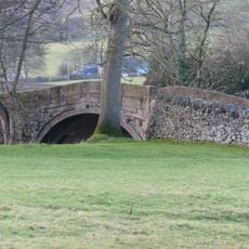
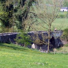
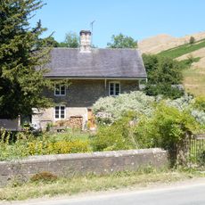
Ilam Park is a country estate and parkland that stretches alongside the River Manifold in the Peak District. The grounds feature ancient woodlands, formal gardens, and open grasslands across roughly 158 acres with various pathways for exploration.

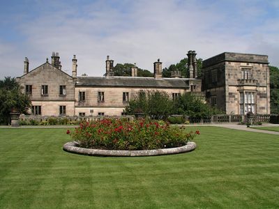
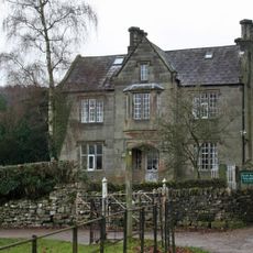
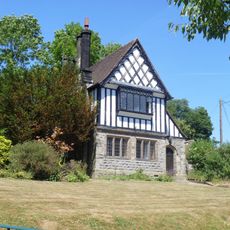
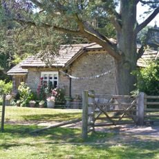
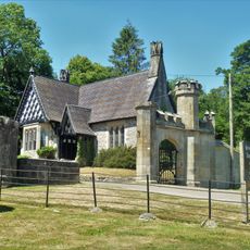
The original manor dating from 1807 was replaced in 1821 by a new hall designed by architect John Shaw for Jesse Watts-Russell. The estate was later taken over by the National Trust and now serves as a youth hostel.

The Grade II* listed Ilam Hall now functions as a youth hostel, managed by the National Trust as part of their conservation efforts.

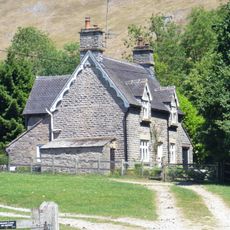
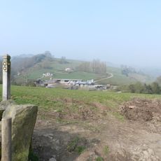
The grounds are open for walking and exploration along the river and through the woodlands. Visitors should wear suitable footwear for uneven terrain and check the weather before planning outdoor activities.

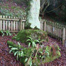
Hinkley Wood within the estate holds status as a Site of Special Scientific Interest due to its rare tree species. This protected woodland area displays botanical diversity that is quite unusual for the region.

The community of curious travelers

AroundUs brings together thousands of curated places, local tips, and hidden gems, enriched daily by 60,000 contributors worldwide.

Start exploring
Location
Address
Ilam Hall, Ilam, Ashbourne DE6 2AZ, UK
GPS coordinates
53.05300,-1.80546
Latest update
December 8, 2025 19:58
Around this place
Church of the Holy Cross
United Kingdom

Church of the Holy Cross

139 m
Tower Aproximately 20 Yards North Of Ilam Hall
United Kingdom

Tower Aproximately 20 Yards North Of Ilam Hall

60 m
Fountain Cottages
United Kingdom

Fountain Cottages

442 m
Mrs Watts-Russell Memorial
United Kingdom

Mrs Watts-Russell Memorial

438 m
St Bertram's Bridge
United Kingdom

St Bertram's Bridge

168 m
Croft Cottage
United Kingdom

Croft Cottage

486 m
The Cottage
United Kingdom

The Cottage

409 m
Dovedale House
United Kingdom

Dovedale House

295 m
Bridge View Cottage
United Kingdom

Bridge View Cottage

456 m
Gate, Gate Piers And Adjoining Walls To Ilam Park
United Kingdom

Gate, Gate Piers And Adjoining Walls To Ilam Park

354 m
Anglo-Scandinavian cross, 7m south of the south transept of the Church of the Holy Cross
United Kingdom

Anglo-Scandinavian cross, 7m south of the south transept of the Church of the Holy Cross

139 m
Bridge over River Manifold
United Kingdom

Bridge over River Manifold

452 m
River Lodge
United Kingdom

River Lodge

1.1 km
School House
United Kingdom

School House

420 m
Coach House And Stable Block Approximately 20 Yards South West Of Ilam Hall
United Kingdom

Coach House And Stable Block Approximately 20 Yards South West Of Ilam Hall

39 m
Musden Grange And Attached Stable
United Kingdom

Musden Grange And Attached Stable

917 m
Ilam Church Of England School
United Kingdom

Ilam Church Of England School

422 m
Home Farmhouse
United Kingdom

Home Farmhouse

475 m
Anglo-Scandinavian cross, 12m south of the south porch of the Church of the Holy Cross
United Kingdom

Anglo-Scandinavian cross, 12m south of the south porch of the Church of the Holy Cross

126 m
St Marys Bridge
United Kingdom

St Marys Bridge

1.5 km
Anglo-Scandinavian cross, 240m south west of Ilam Hall
United Kingdom

Anglo-Scandinavian cross, 240m south west of Ilam Hall

279 m
Grave Cover Approximately 20 Yards South Of West Tower Of Church Of Holy Cross
United Kingdom

Grave Cover Approximately 20 Yards South Of West Tower Of Church Of Holy Cross

123 m
Turret, Loggia, Steps And Parapet To Terrace Immediately South South East Of Ilam Hall
United Kingdom

Turret, Loggia, Steps And Parapet To Terrace Immediately South South East Of Ilam Hall

50 m
Church Lodge
United Kingdom

Church Lodge

181 m
Rushley Bridge
United Kingdom

Rushley Bridge

1.2 km
Gatehouse Lodge
United Kingdom

Gatehouse Lodge

353 m
Milestone, SW of Blore cross-roads
United Kingdom

Milestone, SW of Blore cross-roads

1.3 km
Townend Cottage
United Kingdom

Townend Cottage

536 m
Show the full map
Reviews
Share your experience

No review yet

Discussions
Start a discussion...

No discussion yet

« Ilam Park - Country estate and parkland in Ilam, England » is provided by Around Us (aroundus.com). Images and texts are derived from Wikimedia project under a Creative Commons license. You are allowed to copy, distribute, and modify copies of this page, under the conditions set by the license, as long as this note is clearly visible.

Discover hidden gems everywhere you go!

From secret cafés to breathtaking viewpoints, skip the crowded tourist spots and find places that match your style. Our app makes it easy with voice search, smart filtering, route optimization, and insider tips from travelers worldwide. Download now for the complete mobile experience.

Around Us App Screenshot

A unique approach to discovering new places

Le Figaro

All the places worth exploring

France Info

A tailor-made excursion in just a few clicks

20 Minutes

Around Us
Travel Guide & Maps
Download

Send to your phone

QR Code
1

Open the camera app on your mobile.

2

Point at the QR code with your camera. A notification will appear.

3

Tap the notification to open the link.