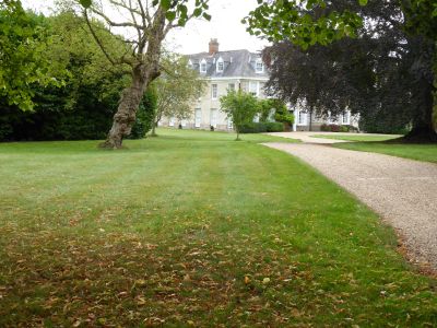
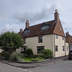
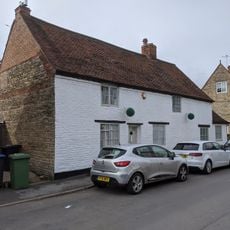
Ladbroke Hall, Manor house in Ladbroke, England.
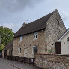
Ladbroke Hall is a symmetrical manor house with an H-shaped layout, two storeys, and gabled attics situated in Ladbroke, England. The building is constructed from limestone and lias stone, features seven bays, multiple sash windows with stone surrounds, and a main entrance with a six-panelled door and rectangular overlight.
The estate passed to William Palmer in 1633 and remained within his family for several generations. In the 19th century, Charles Rowland Palmer-Morewood managed the extensive property.
The hall displays refined craftsmanship from the early 18th century, with six-panelled doors featuring decorative moulding and carved wooden fireplace surrounds throughout. These handmade details give the interior spaces their distinctive character.
The building is straightforward to identify from outside, with its distinctive stone walls and paired sash windows that clearly show its age. Access may be limited, so visitors should check ahead about viewing opportunities.
The interior staircase shows an unusual mix of three different baluster styles - twisted, barley-sugar, and fluted - combining to form an open-well design with carved string features. This variety of balusters from different periods gives the staircase an unexpected character.
Location: Ladbroke
GPS coordinates: 52.22480,-1.39400
Latest update: December 12, 2025 14:21
Ufton Fields
4.5 km
PILLBOX (TYPE FW3/26), Lock No.10 (Oxford Canal), Chapel Green, near Napton on the Hill.
4.5 km
Congregational Church
3.2 km
Church of St James
3.1 km
Church of All Saints
255 m
Church of All Saints
4.3 km
Church of St Michael
5 km
Church of St Michael
2.9 km
Church House
4.2 km
The Crown Inn
4.2 km
Wissett Lodge
4.2 km
Napton Windmill
5 km
Bascote Heath And Stoneythorpe War Memorial
4.4 km
'The Holy Well'
3.2 km
Napton Bottom Lock, Oxford Canal
4.7 km
Former Font Approximately 0.5 Metres West Of Tower Of Church Of All Saints
4.2 km
Harbury War Memorial
4.2 km
Oxford Canal, Canal Bridge Number 122
5.1 km
Oxford Canal Bridge Number 125
5.2 km
Chest Tomb Approximately 0.5 Metres East Of South Aisle Of Church Of All Saints
4.2 km
Harbury Windmill
4.4 km
The Homestead
4.2 km
Butchers
4.4 km
Stockwell Farmhouse
4.5 km
Milestone At National Grid Reference Sp 3928 5935
2.4 km
The Old Rectory
294 m
The medieval settlement at Wormleighton
5.4 km
Milepost, 60m W of jct with B4452
4.4 kmVisited this place? Tap the stars to rate it and share your experience / photos with the community! Try now! You can cancel it anytime.
Discover hidden gems everywhere you go!
From secret cafés to breathtaking viewpoints, skip the crowded tourist spots and find places that match your style. Our app makes it easy with voice search, smart filtering, route optimization, and insider tips from travelers worldwide. Download now for the complete mobile experience.
A unique approach to discovering new places❞
— Le Figaro
All the places worth exploring❞
— France Info
A tailor-made excursion in just a few clicks❞
— 20 Minutes