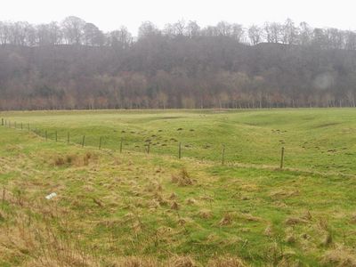
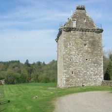
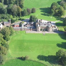
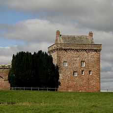
Liddel Strength, Medieval motte-and-bailey castle in Kirkandrews, England.
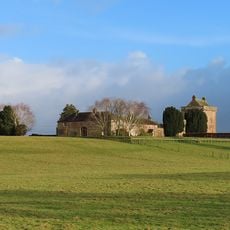
Liddel Strength is a motte-and-bailey castle whose remains include a raised mound about 6.6 meters high, surrounded by inner and outer fortified areas. Deep ditches encircle the site and divide the different sections of the fortification.
The fort was founded in 1174 and fell in 1346 when King David II of Scotland captured it with his forces. After this defeat, the site lost its role as an active military stronghold.
This fortress served as a key defensive point along the England-Scotland border and represented the seat of power for the Liddel barony during the medieval period. The layout reflects how important controlling this territory was for local authority.
The site offers open access to outdoor grounds marked by natural boundaries created by ancient ditches and earthworks. Visitors should expect uneven terrain and wear sturdy footwear, as the slope of the mound can be slippery.
Beneath the turf in the inner ward lie the remains of an original tower that was never rebuilt after its destruction. This hidden feature serves as a quiet reminder of the violence the fortress endured during its final capture.
Location: Kirkandrews
GPS coordinates: 55.05830,-2.93780
Latest update: December 8, 2025 21:05
Gilnockie Tower
4.8 km
Fairy Loup
4.1 km
Coop House, Netherby
3.1 km
Castra Exploratorum
2.5 km
Riddings Junction Viaduct
1.7 km
Gilnockie Bridge
4.3 km
Byreburnfoot Bridge
4 km
Priorslynn
1.9 km
Penton Bridge
4.5 km
Church of St Andrew
2.4 km
Kilnholme
4.9 km
Penton Linns
4.3 km
Milestone, SE of Penton House, jct with UC road to Watleyhirst
4.3 km
Canonbie War Memorial
2.4 km
Netherby Hall
2.6 km
Longtown Bridge
5.8 km
Suspension Bridge
2.4 km
Canonbie Bridge
2.5 km
Canonbie, Free Church Manse
3.2 km
Milestone South West Of Netherby Hall At Ngr 395 708
3.4 km
2 And 4A, Graham Street
5.8 km
Kirkandrews Tower
2.6 km
Milestone At Ngr 386 722
2.4 km
Milestone North East Of Tilekiln Wood At Ngr 421 746
2 km
Milestone At Ngr 409 736
933 m
Milestone North Of Sandbed At Ngr 371695
5.5 km
Farmhouse And Barn Adjoining Wall To West Of Kirkandrews Tower
2.6 km
Milestone, Batenbush, 15m N of entrance to wood
4 kmVisited this place? Tap the stars to rate it and share your experience / photos with the community! Try now! You can cancel it anytime.
Discover hidden gems everywhere you go!
From secret cafés to breathtaking viewpoints, skip the crowded tourist spots and find places that match your style. Our app makes it easy with voice search, smart filtering, route optimization, and insider tips from travelers worldwide. Download now for the complete mobile experience.
A unique approach to discovering new places❞
— Le Figaro
All the places worth exploring❞
— France Info
A tailor-made excursion in just a few clicks❞
— 20 Minutes