Enable Location

We need your location to show you interesting places around you

Discover nearby places

Find interesting locations and hidden gems around you

Precise directions

Get accurate directions and distances to places

Your location is never shared with other users. It's only used when you tap the location button.

Salle Park

Log in to your account

Start exploring — it's free

Trusted by 62,515 travelers worldwide

Continue with Google
Continue with Apple
or

We will send you a code to connect

By continuing, you accept our Terms and Conditions and our Privacy Policy

Check your inbox

We've sent a pincode in your inbox. Please enter the code below.

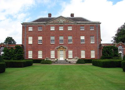
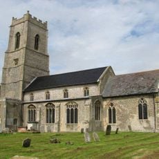
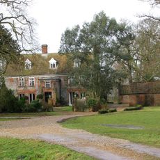
Salle Park, Grade II* listed country house in Salle, Norfolk.

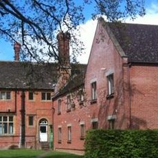
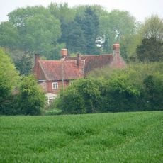
Salle Park is a country estate in Norfolk featuring a Palladian-style mansion built in the early 1800s. The main house sits within gardens spanning around 75 hectares, surrounded by woodland and farmland that make up the larger 1,681-hectare property.

The house was built in 1763 for Edward Hase and passed to the Jodrell family in 1772 through the marriage of Vertue Hase to dramatist Richard Paul Jodrell. This connection with a literary family shaped the estate for generations to come.

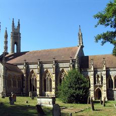
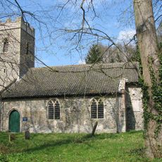
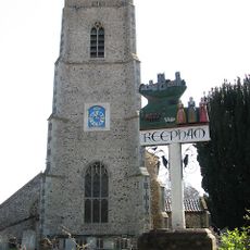
The park takes its name from a nearby Norman church, reflecting the rural identity of the region. Visitors can experience the formal gardens as an expression of 18th-century English landscape design, with their manicured lawns and clipped hedging.

Guided tours of the gardens are available by reservation and offer the best way to explore the grounds. Visitors should be aware the estate covers a large area, so comfortable shoes are recommended.

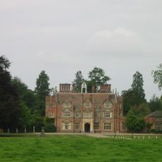
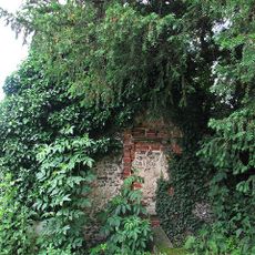
A walled kitchen garden from the 1780s sits about 350 meters southwest of the main house and demonstrates the separate utility structures typical of historic estates. This outbuilding often goes unnoticed by visitors despite revealing the practical side of country life.

The community of curious travelers

AroundUs brings together thousands of curated places, local tips, and hidden gems, enriched daily by 60,000 contributors worldwide.

Start exploring
Location
GPS coordinates
52.77710,1.13604
Latest update
December 9, 2025 12:21
Around this place
Heydon Hall
United Kingdom

Heydon Hall

3.1 km
St Michael the Archangel's Church, Booton
United Kingdom

St Michael the Archangel's Church, Booton

2.3 km
St Faith's Church, Little Witchingham
United Kingdom

St Faith's Church, Little Witchingham

4.3 km
St Nicholas' Church, Brandiston
United Kingdom

St Nicholas' Church, Brandiston

4 km
Church of Saints Peter and Paul
United Kingdom

Church of Saints Peter and Paul

668 m
Church of St Peter and St Paul
United Kingdom

Church of St Peter and St Paul

2.9 km
The Parish Church of St Agnes
United Kingdom

The Parish Church of St Agnes

1.9 km
Church of St Michael and All Angels
United Kingdom

Church of St Michael and All Angels

2.3 km
Church of St Mary
United Kingdom

Church of St Mary

4.7 km
Church of the Nativity of St Mary
United Kingdom

Church of the Nativity of St Mary

2.3 km
Church of St Peter and St Paul
United Kingdom

Church of St Peter and St Paul

4.4 km
Church of St Andrew
United Kingdom

Church of St Andrew

3.6 km
Cawston Water Tower
United Kingdom

Cawston Water Tower

4.6 km
Cawston Manor
United Kingdom

Cawston Manor

4.7 km
The Bell
United Kingdom

The Bell

2 km
The Old Brewery House, Gates And Railings
United Kingdom

The Old Brewery House, Gates And Railings

2.3 km
Moor Hall
United Kingdom

Moor Hall

1.7 km
Fragment. Church Of All Saints. 14 Metres South West Of St Michaels Church
United Kingdom

Fragment. Church Of All Saints. 14 Metres South West Of St Michaels Church

2.3 km
Cropton Hall
United Kingdom

Cropton Hall

3.9 km
Wayside cross 160m north west of Stump Cross Farm
United Kingdom

Wayside cross 160m north west of Stump Cross Farm

4.6 km
Old Hall
United Kingdom

Old Hall

2.9 km
Milestone, c.250yds S of lodge to Heydon Hall
United Kingdom

Milestone, c.250yds S of lodge to Heydon Hall

3.3 km
Milestone, on bend c.1/2m S of Corpusty church
United Kingdom

Milestone, on bend c.1/2m S of Corpusty church

4.3 km
Milestone, Norwich Road, by "Grey Gables",
United Kingdom

Milestone, Norwich Road, by "Grey Gables",

3.3 km
Milestone, 15yds E of white iron gate into Salle Park
United Kingdom

Milestone, 15yds E of white iron gate into Salle Park

323 m
Milepost, c.100yds S of NT Memorial Stone
United Kingdom

Milepost, c.100yds S of NT Memorial Stone

4 km
Milestone, c.150yds S of railway bridge
United Kingdom

Milestone, c.150yds S of railway bridge

3.3 km
Milestone, 3yds N of jct with rd to Heydon
United Kingdom

Milestone, 3yds N of jct with rd to Heydon

3.1 km
Show the full map
« Salle Park - Grade II* listed country house in Salle, Norfolk » is provided by Around Us (aroundus.com). Images and texts are derived from Wikimedia project under a Creative Commons license. You are allowed to copy, distribute, and modify copies of this page, under the conditions set by the license, as long as this note is clearly visible.

Discover hidden gems everywhere you go!

From secret cafés to breathtaking viewpoints, skip the crowded tourist spots and find places that match your style. Our app makes it easy with voice search, smart filtering, route optimization, and insider tips from travelers worldwide. Download now for the complete mobile experience.

Around Us App Screenshot

A unique approach to discovering new places

Le Figaro

All the places worth exploring

France Info

A tailor-made excursion in just a few clicks

20 Minutes

Around Us
Travel Guide & Maps
Download

Send to your phone

QR Code
1

Open the camera app on your mobile.

2

Point at the QR code with your camera. A notification will appear.

3

Tap the notification to open the link.