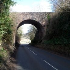
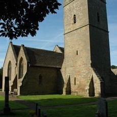
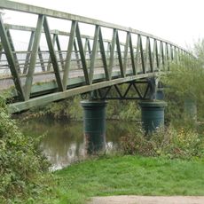
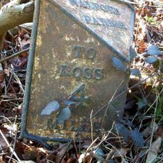
Kerne Bridge, Road bridge in Goodrich, England
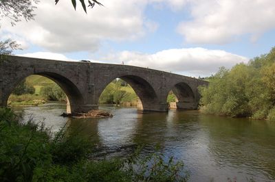
Kerne Bridge is a stone arch bridge with five spans that crosses the River Wye between Goodrich and Walford along the B4229 road. Its structure features local sandstone masonry and includes stepped access from the lower level for pedestrians.
Completed in 1828, it replaced an ancient ford known as Flanesford that had served for centuries. This structure subsequently supported the movement of industrial goods including iron and coal from the Forest of Dean region.
The bridge has served as a crossing point that shaped life in both villages for nearly two centuries. Today, it remains a landmark that locals and visitors use to traverse the river and experience the Wye Valley landscape.
The bridge remains open to both vehicles and pedestrians with accessible stairs from both approaches. The site sits above flowing water, so visitors should be mindful of weather conditions and river levels when crossing.
The bridge displays carefully crafted stone voussoirs and segmental arches that reveal skilled masonry techniques from the 1800s. These architectural details, often overlooked by casual visitors, demonstrate the precision required to build such crossing points without modern equipment.
Location: Goodrich
Location: Walford
Inception: 1828
GPS coordinates: 51.87000,-2.61029
Latest update: December 14, 2025 11:21
Goodrich Court
1.4 km
Flanesford Priory
241 m
Church of St Giles
875 m
Rocklands
1.5 km
Goodrich Castle
833 m
Dry Arch Bridge 300yds NE of St Giles' Church
544 m
Ye Hostelrie
659 m
Church of St Michael
1.3 km
Tovey Monument Approximately 0.25 Metres From South Wall Of Nave Of Church Of St Giles
873 m
Gritton Monument approximately 30 metres south-west of west tower of Church of St Giles
906 m
Huntsham Bridge
1.7 km
Walford War Memorial
1.4 km
Edwards Monument approximately 1 metre south of organ chamber of Church of St Giles
867 m
Goodrich War Memorial
607 m
Goodrich Manor
1.4 km
Milestone
718 m
Milepost, Kerne Bridge; opp. Hazelhurst Bungalows
716 m
New Barn House And Attached Outhouse
1.4 km
Chest tomb against south wall of nave east of porch of Church of St Giles
877 m
The South Lodge
970 m
Group of three headstones approximately 3 metres south-west of south porch of Church Of St Giles
887 m
Flanesford Priory Farmhouse
204 m
Base of churchyard cross with shaft approximately 2 metres south of south porch of Church of St Giles
880 m
The Old Court
1 km
Upper Granton
953 m
Cider mill at Flanesford Priory
197 m
Whitehall
965 m
Stone bench approximately 18 metres east of chancel of Church of St Giles
844 mVisited this place? Tap the stars to rate it and share your experience / photos with the community! Try now! You can cancel it anytime.
Discover hidden gems everywhere you go!
From secret cafés to breathtaking viewpoints, skip the crowded tourist spots and find places that match your style. Our app makes it easy with voice search, smart filtering, route optimization, and insider tips from travelers worldwide. Download now for the complete mobile experience.
A unique approach to discovering new places❞
— Le Figaro
All the places worth exploring❞
— France Info
A tailor-made excursion in just a few clicks❞
— 20 Minutes