Castle Hill earthwork, archaeological site in Brighton and Hove, East Sussex, England, UK
Location: Brighton and Hove
GPS coordinates: 50.84400,-0.04380
Latest update: November 24, 2023 23:50
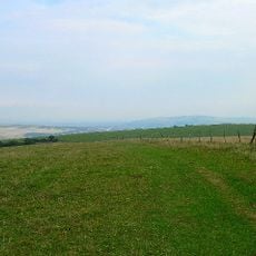
Castle Hill, Brighton
684 m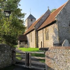
St Pancras Church (Kingston near Lewes)
1.9 km
Kingston Escarpment and Iford Hill
1.3 km
Friars Cottage
1.8 km
Hollowdown Cottages
2.1 km
Kingston Manor
1.8 km
A cross-ridge dyke and part of an adjoining cross-ridge dyke meeting at Juggs Road near Falmer Bottom
971 m
Hyde Manor
1.9 km
Garden Wall Of Gazebo
1.8 km
A group of three bowl barrows and an Anglo-Saxon barrow field on The Bostle
1.5 km
Manor Barn
1.8 km
Bronze Age and Anglo-Saxon barrow cemeteries south of Juggs Road
805 m
Kingston
1.8 km
Juggs Way
1.9 km
The Walls Of The Village Pound
1.9 km
Bowl barrow south of Newmarket Bottom
1.1 km
Gazebo To South West Of Kingston Manor
1.7 km
Bowl barrow 640m SSW of Saxondown Farm: part of a round barrow cemetery
1.2 km
Barn, Cattle Shed And Granary At Kingston Farm
1.9 km
Bowl barrow 670m south west of Saxondown Farm: part of a round barrow cemetery
1.2 km
Barn In The Field To The South East Of Manor Barn
1.8 km
Hyde Cottage
2 km
Kingston Lodge
2 km
Barn Cottage
2 km
6 And 7, The Street
2 km
Medieval enclosure W of Newmarket Plantation
1.8 km
The Village Shop And Post Office
2.1 km
Rest Harrow
2.1 kmReviews
Visited this place? Tap the stars to rate it and share your experience / photos with the community! Try now! You can cancel it anytime.
Discover hidden gems everywhere you go!
From secret cafés to breathtaking viewpoints, skip the crowded tourist spots and find places that match your style. Our app makes it easy with voice search, smart filtering, route optimization, and insider tips from travelers worldwide. Download now for the complete mobile experience.

A unique approach to discovering new places❞
— Le Figaro
All the places worth exploring❞
— France Info
A tailor-made excursion in just a few clicks❞
— 20 Minutes